Old Colorado gold mine exploration & history
|
Family has a chance to visit and there's a desire to see mining history, and
where possible, a campsite near a creek or lake. Check! I've been
looking forward to the trip and have been thinking of what to visit.
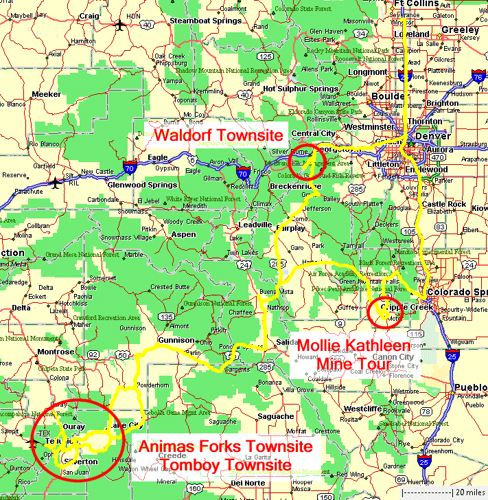
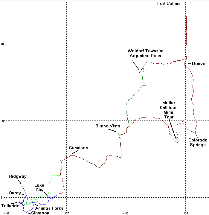
There's a fair bit on the list - we'll see what can be fit in. Three big items include the Animas Forks townsite, the Tomboy townsite, and the Mollie Kathleen mine tour. Checking the weather decided what would happen first - the townsites near Ouray in southwest Colorado. If it's raining while we are at the mine tour - we won't know it as we'll be 1000' underground! This trip report covers multiple days and, as is typical, one day per page of pictures. As some of the days have a large number of pictures I'm presenting this write-up in two versions - full and highlights. The full version will display all that can be displayed for the day. The highlights version will display only the best items for the day. You can switch back and forth as you wish. At the bottom of this page are the links to get started! |
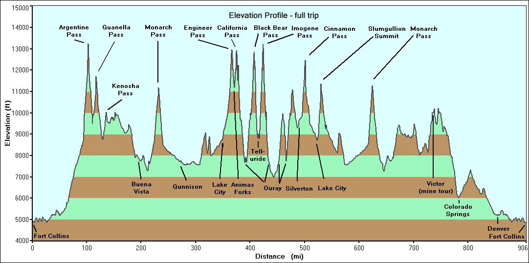
| Speed Max Speed Avg Hwy+Trail Speed Avg Trail Distance Hwy+Trail Distance Trail Time Elapsed Elevation Start Elevation End Elevation Max Elevation Min |
71 14 3 109 13.8 7:42 4,921 10,399 13,253 4,845 |
mph mph mph miles miles hh:mm feet feet feet feet |
Day 1 - Sunday, July 12 Fort Collins to DIA to Fort Collins to Argentine Pass / Waldorf townsite, camping - dispersed Photo set: FULL (21) HIGHLIGHTS (11) |
| Speed Max Speed Avg Hwy+Trail Speed Avg Trail Distance Hwy+Trail Distance Trail Time Elapsed Elevation Start Elevation End Elevation Max Elevation Min |
69 20 2 185 1.8 9:20 10,467 7,691 11,706 7,262 |
mph mph mph miles miles hh:mm feet feet feet feet |
Day 2 - Monday, July 13 Argentine Pass to Gunnison - Guanella Pass lunch by the stream, chili cheese dogs dinner at the Blue Mesa Reservoir, motel Photo set: FULL (40) HIGHLIGHTS (33) |
| Speed Max Speed Avg Hwy+Trail Speed Avg Trail Distance Hwy+Trail Distance Trail Time Elapsed Elevation Start Elevation End Elevation Max Elevation Min |
66 9 4 106 33.7 12:20 7,691 9,812 12,965 7,543 |
mph mph mph miles miles hh:mm feet feet feet feet |
Day 3 - Tuesday, July 14 Gunnison, Lake City, Engineer Pass, Animas Forks townsite, camping - dispersed Photo set: FULL (192) HIGHLIGHTS (113) |
| Speed Max Speed Avg Hwy+Trail Speed Avg Trail Distance Hwy+Trail Distance Trail Time Elapsed Elevation Start Elevation End Elevation Max Elevation Min |
61 5 3 59 27.7 12:09 9,879 9,885 13,228 6,977 |
mph mph mph miles miles hh:mm feet feet feet feet |
Day 4, Wednesday, July 15 Black Bear Pass, Tomboy townsite, Imogene Pass, camping - same site Photo set: FULL (129) HIGHLIGHTS (77) |
| Speed Max Speed Avg Hwy+Trail Speed Avg Trail Distance Hwy+Trail Distance Trail Time Elapsed Elevation Start Elevation End Elevation Max Elevation Min |
53 7 7 80 17 10:43 9,951 9,402 12,454 7,732 |
mph mph mph miles miles hh:mm feet feet feet feet |
Day 5, Thursday, July 16 Ironton, Silverton, Animas Forks townsite, Cinnamon Pass, Lake City, camping - FS campground Photo set: FULL (107) HIGHLIGHTS (51) |
| Speed Max Speed Avg Hwy Distance Highway Time Elapsed Elevation Start Elevation End Elevation Max Elevation Min |
77 28 367 12:52 9,421 4,859 11,268 4,850 |
mph mph miles hh:mm feet feet feet feet |
Day 6, Friday, July 17 Drive to Cripple Creek for the Mollie Kathleen mine tour, trek to Fort Collins Photo set: FULL (99) HIGHLIGHTS (45) |