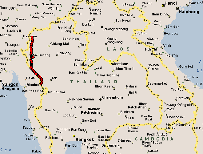
Mae Hong Son to Mae Sot
| Yesterday was a twisty - and slow - hop up and
over the hills. Today looks to be a faster ride along with the hills.
Such was the case, mostly. Elevations for the day kept between 400 feet
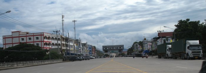
and 1600 feet. Right about 500 kilometers by the maps. Mae Hong Son, the north end and my start, to Mae Sariange, about midway, to Mae Sot at the south. I should have thought about continuing on to Tak - about one more hour riding - I had the daylight - but I didn't have it on my mental list and I called it a day at Mae Sot. The "top half" - Mae Hong Son to Mae Sariange - was mostly quick with decent roads. Sweepers, Thailand style, with just a few switchbacks for diversity. The "bottom half" would be a mixed bag. Traffic ceased shortly south of Mae Sariange and the roadway narrowed. This remote riding lasted for an hour or more. There was a mix of fresh asphalt, cement, narrow asphalt, gravel. A noted difference would be the amount of twigs and branches on the roadway - not enough vehicles pass through to break them up and keep the road clear. While there was little traffic (no power lines - ubiquitous with most roadways) there were people. An occasional hill tribe village set away from the road. Only a small path here and there. The villages had no power, no phone, no machines - just hand tools. The huts would be off in a field or on the hillside. Plots of farmed land here and there. Some of the hillsides were cleared and planted but not many. The area was remote in feeling - an enjoyed feeling. Unfortunately it would be a wet day - Rain for a good portion of the ride (not many photos). With the large amount of trees and plant growth the "views out" were uncommon. At one spot, in a more traveled area (waypointed on the GPS), I came across a LARGE village. Several hundred to maybe a couple thousand huts. Cement posts with barbed wire separated the huts from the roadway (the barbed wire fence was more for looks than to keep someone from crossing it - perhaps to keep people on the road - visitors like me - out). I stopped to remove the rain jacket and was thinking of taking a photo or two but with the amount of people walking about I decided to leave the camera tucked away (the Lonely Planet book said to ask permission before photographing any of the hill tribes). The village had a large shear rock face to the west, the road on the east. The distance between the two was less than 1/4 mile. The length of the place was about a 1/2 mile or more. A lot going on. Some Internet research will be needed. Coming into Mae Sot the school kids were out and heading home. I noticed a kid on a scooter who seemed to be leaning way far back on the bike - and then I noticed the muffler pointing a bit down. I couldn't get my hands on the camera fast enough - no vid or photo. The driver was riding a wheelie on the small bike. Having the passenger lean back made the wheelie easier. I rode to the Thailand-Myanmar border crossing - nothing of interest - so I headed back the 4 kilometers to Mae Sot to settle in. |
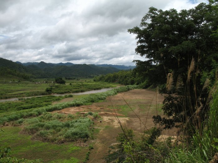
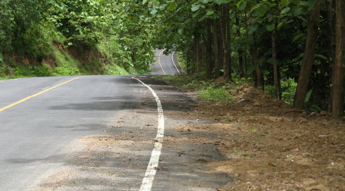
| A bit of the valley I've been following. The road is hugging the lower slope on the eastern wall so the road offers nominal elevation change and ample, gentle curves. |
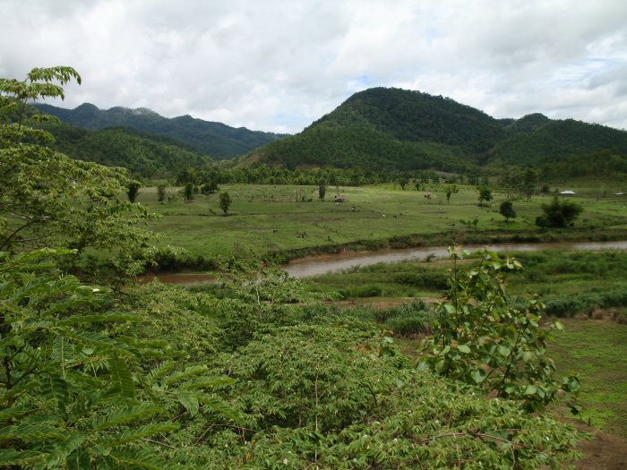
| A fair bit of this for the first half of the day - enjoyable. |
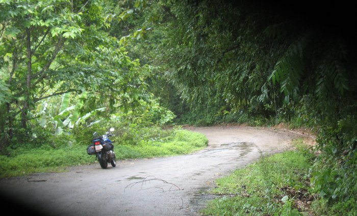
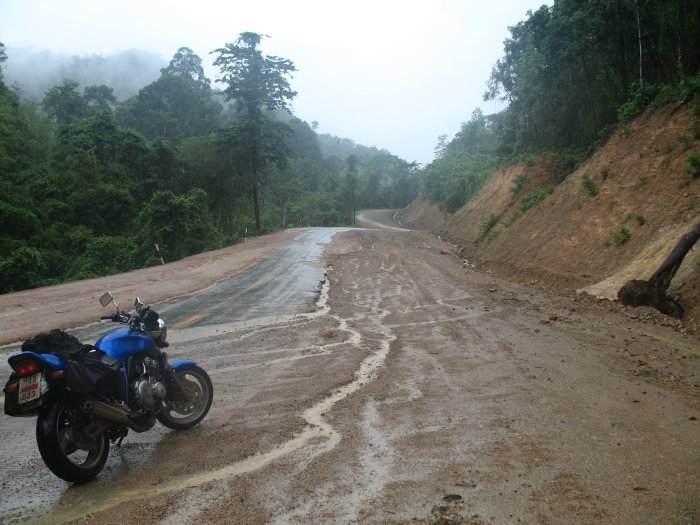
| In the "remote section" for the day - one of the smaller, little traveled sections of road. |
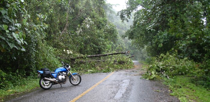
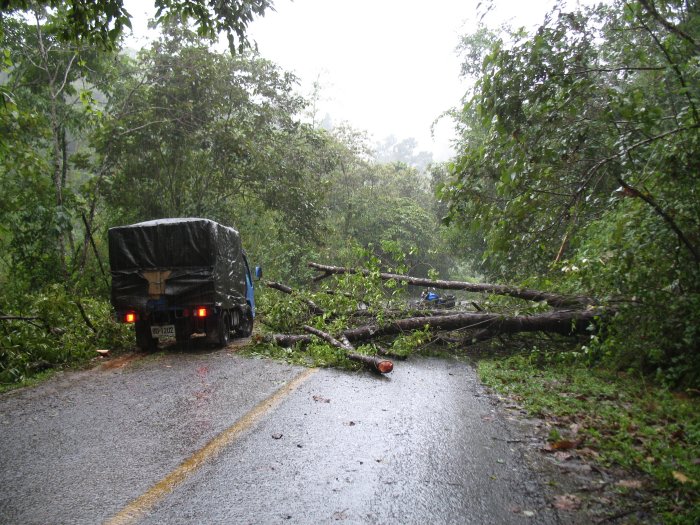
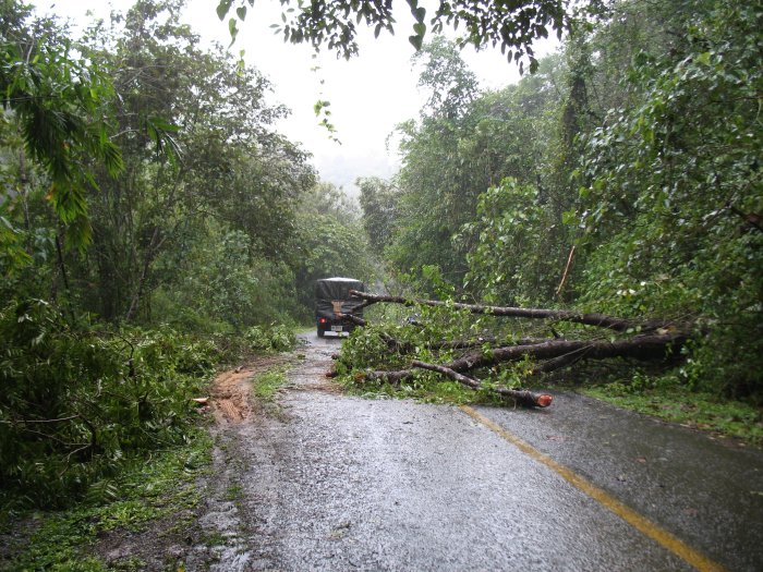
| Erosion caused the tree to recently fall. Branches were hacked to open things up. |
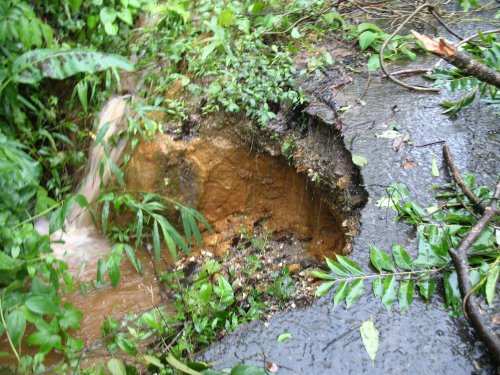
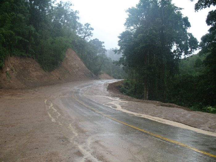
| This was an entertaining area - a layer of slick mud would run over the asphalt here and there. |
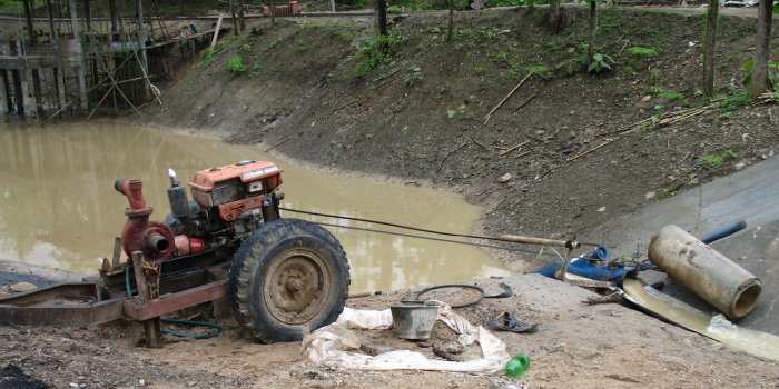
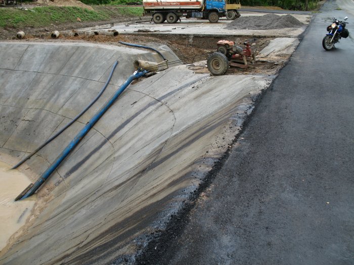
| I stopped to photo this pump setup. There were
a batch of workers off to the right of the photo - they thought me an
oddity for photographing their pump. The long blue tube (bottom right)
is an Archimedean screw and is pumping water from the pond. Ejected
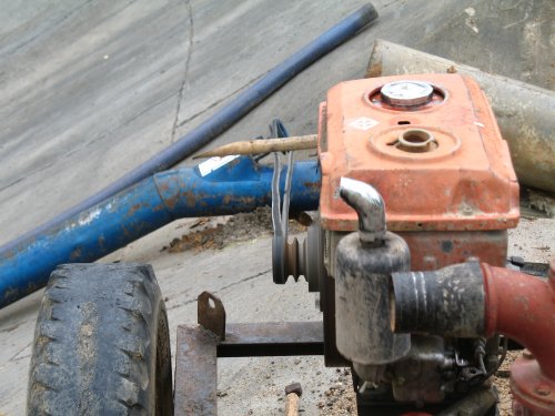
water is visible in the bottom right of the photo. What I got a kick out of was the power setup. That loooooong belt between the engine and screw. Tension / adjustment of the belt? Just pull the engine cart far enough away to tighten the belt and put a rock under the wheel to keep it set - that should do it. This depicts the "can do / get it done" philosophy represented in the way some things are accomplished here (I've offered photos here and there - wiring, plumbing, etc). Apparently the belt would flop off so a vibration dampener was created - two bamboo sections and some sort of wire wrap. The horizontal bamboo would rest on the belt just enough to keep the belt from jumping either pully. |
| A view down the belt - bamboo resting on the belt. |
| Video Pump in action 2006-06-05-pump.mpg MPG, 900 KB, 12 sec |
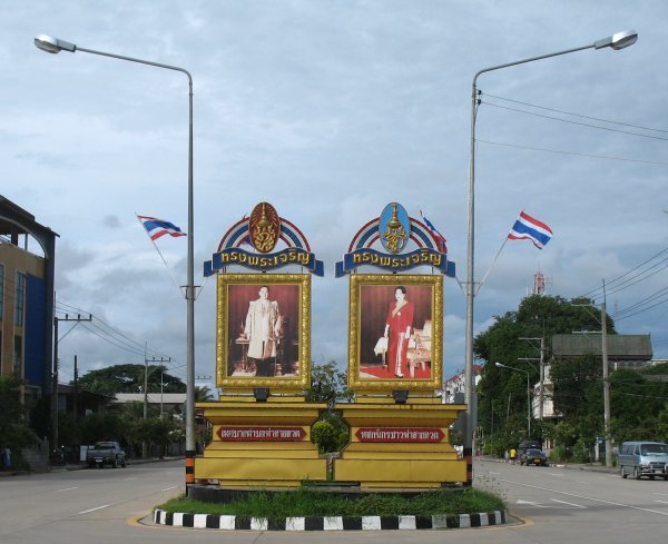
| Down at Mae Sot The King and Queen. Photos / memorials such as this are common. |
| Looking at the Thailand - Myanmar border station. |