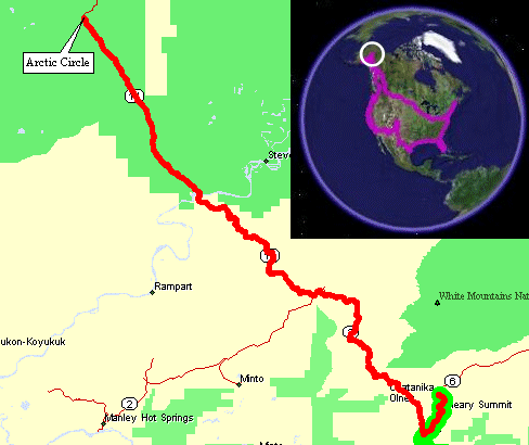
(Round trip)
Video
Arctic Circle & the Yukon River
2005-09-22.mpg
MPG, 5.5 MB, 1 min 19 sec
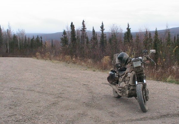
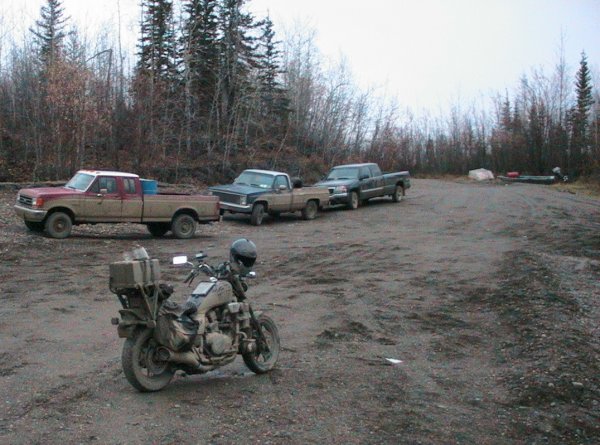
Mountain top rest area
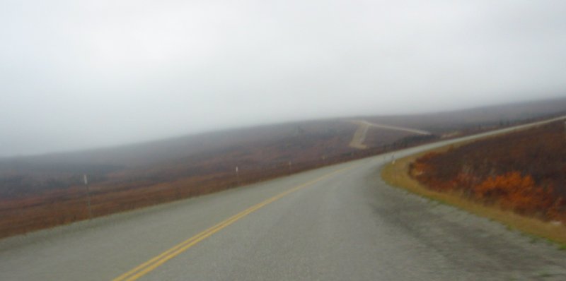
After about 17 miles of gravel/mud there was a road re-alignment that was done with asphalt (smooth riding) - it was a nice 2 to 4 mile rest.
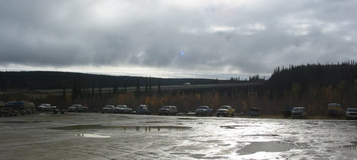
Panorama (click for a larger size)

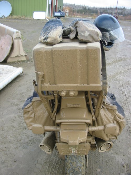
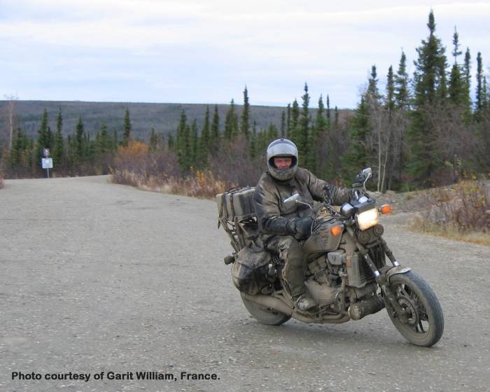
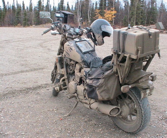
17 Mile mud check - not too bad. Forks are fairly clean and silver.
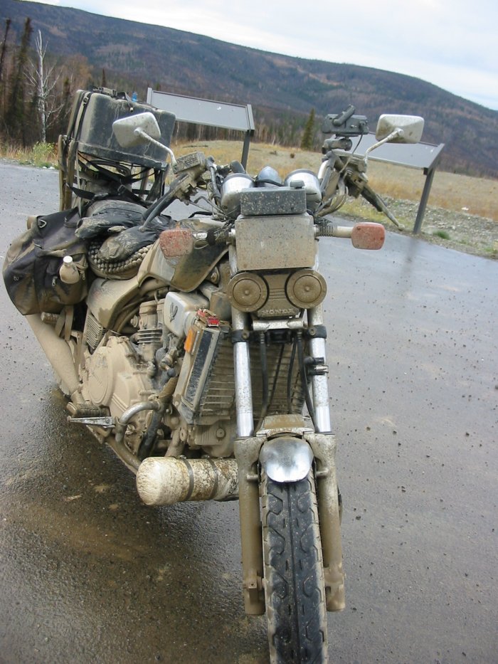
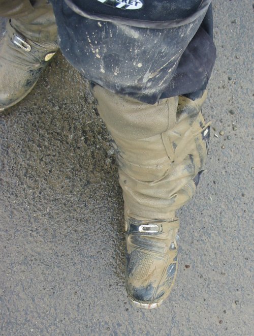
I'm starting to get a bit covered but it's mainly on the lower legs.
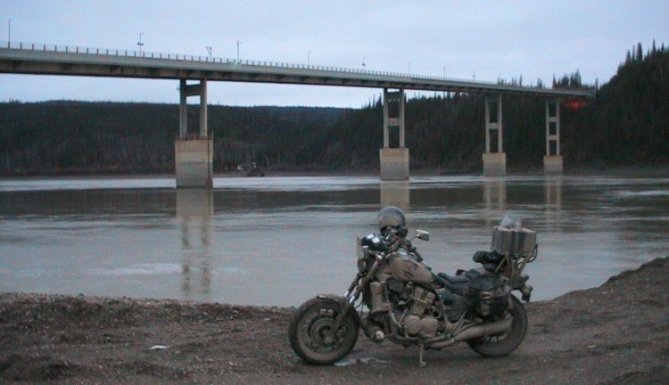
Now I'm at the Yukon River Camp fuel stop - 130 miles so far. About 61 more to the Arctic Circle. The bike, and me, are perhaps the most covered at this point. The rear sports a full, wet coating. The license plate has also been "modified" by the rear wheel - full suspension compression....
Why ride the rutted road at 35 mph and let the bike follow the ruts when you get the suspension working at 45 to 60 mph?? The ride is much smoother - but any quick action to avert that big dip in the road is futile - in ya go. So, why even think of riding faster on a wet, muddy road? After miles of bumps & washboard (some sections of tooth fillings falling out type of stuff) - with miles to go - you really think about doing something different. The road, frankly, wasn't that bad (better than I envisioned) - things just smoothed out nicely up near 50 (the listed limit).
One item of note - the lady at the fuel stop counter said they they may pave the whole road next summer. She was skepticle - but who knows.
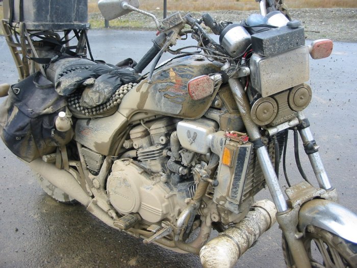
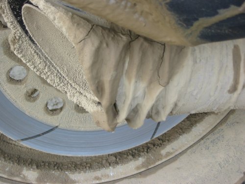
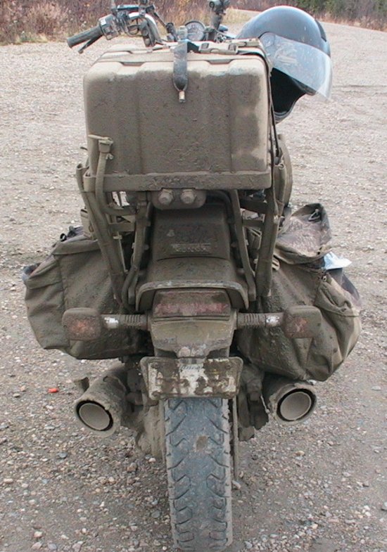
This picture is of the right side muffler (black? saddle bag at the top of the pic and the rear brake roter and wheel lower in the pic). The focus is the set of five "waves" caked onto the muffler. The muffler really is flat and straight.
One item to look at would
be the forks -
the uniform mud covering. Right behind those forks is the
radiator - with its own uniform layer of mud. When I pulled
into
the lot the temp gauge showed three bars - two to three bars being
"normal" - but I also heard the cooling fan running - Hmmmm.
The
outside temps were about 45 F and in this range the cooling system will
get down to zero or one bar - three is unusual. A check of
the
radiator showed a 1/4 to 3/8 inch thick covering over the tops of the
fins. When I (carefully) plucked this layer off (Swiss Army
Knife
- standard screwdriver blade put to the task) I then had to get the mud
out from within the fins. Down to the river I head.
I
pulled the water bottle (right saddle bag) out and filled it up.
Holding a thumb over the open end I aimed and squeezed.
After perhaps 15 bottle sprays it was (I hoped) clear enough.
A good aid in this process was Jessie
(I think I have his name correct) who offered a coffee can to refill
the bottle. This saved a bunch of trips down to the water.
He had pulled up to shore in a two canoe rig. He had been on the river (coming down the Yukon) from Circle, AK. Living off of the land in search of good food to eat. He offered some smoked salmon - it was great - Thanks! We enjoyed a nice conversation - I learned a bit about his trip and living off of the land.
I also met another couple, when fueling up, that I had passed miles earlier. They were stopped and out picking berries. Wiseman, up near Coldfood, is where they live. Should I make it up that far they'd have some hot coffee for me. Not this trip - perhaps the next! We talked about flying and living in the area (that living off of the land theme...). Everyone I meet has been a joy to talk with. I should have asked for a picture of the folks I met at this stop. Perhaps they'll e-mail one to post.
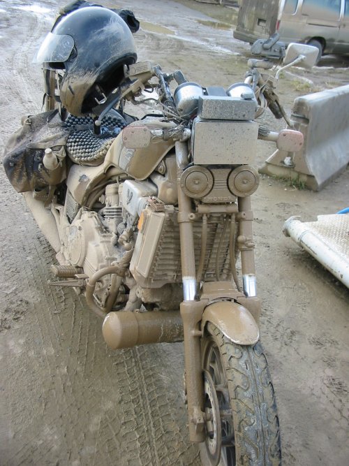
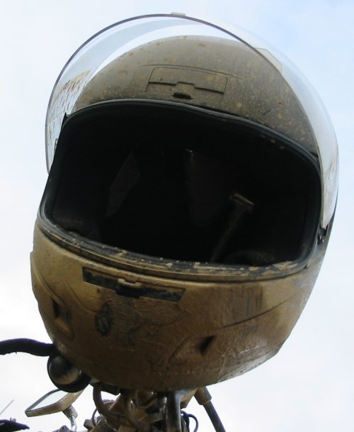
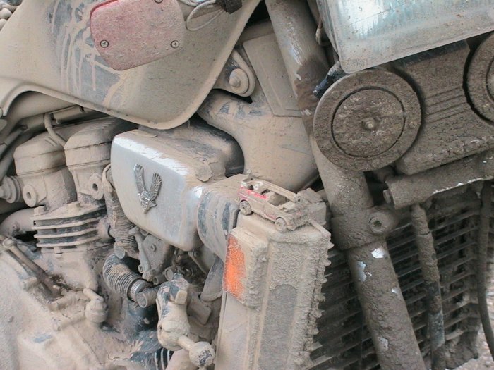
The reason for the forks and radiator to be covered is the same that the helmet is a bit coated - the front wheel spits junk out of the front edge of the fender/top of the tire which then catches the air and floats up and back. Depending upon the wind, speed, type/weight of muck it either goes high (helmet) or low (radiator).
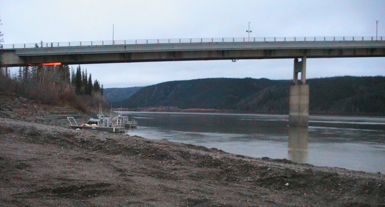
Parking lot at the Yukon River. Bridge.
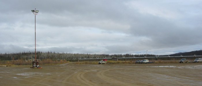
Pipeline
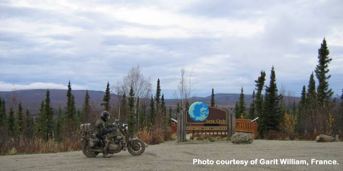
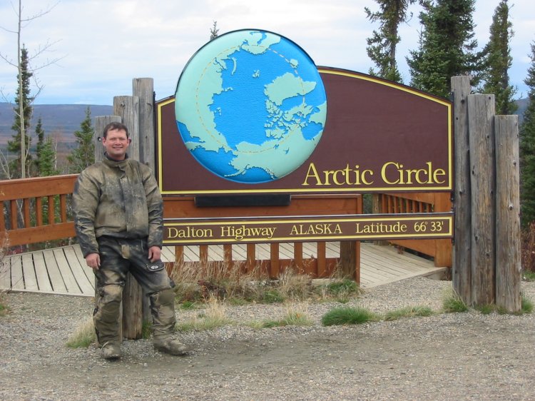
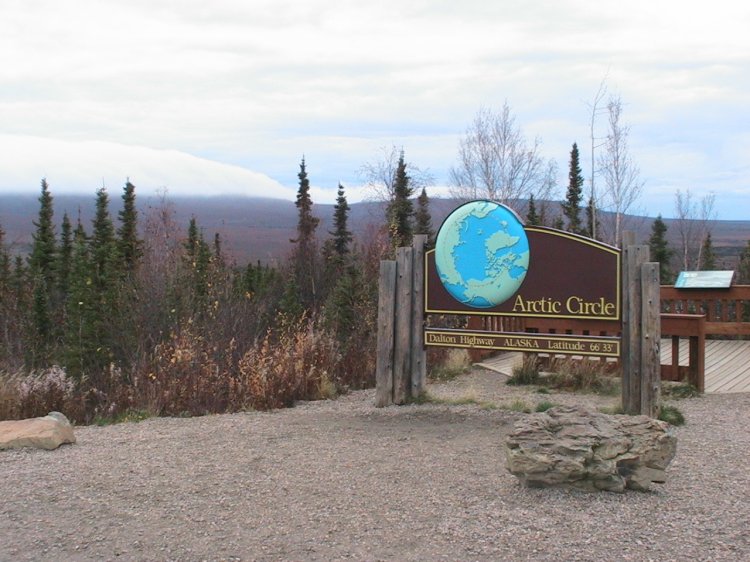
OK, from the Yukon River camp, 34 miles of "not quite so muddy" road then 27 some miles of decent asphalt drops one here: The Arctic Circle.
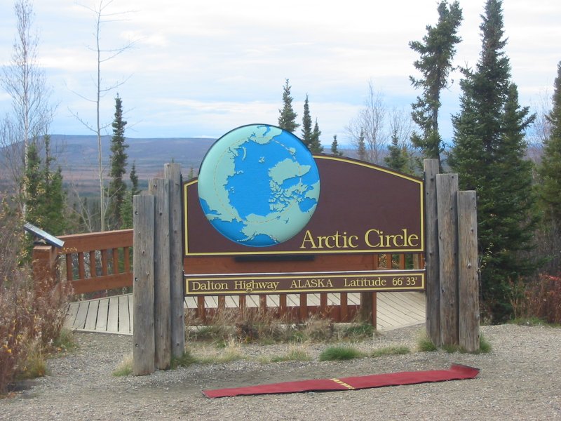
The red pad with the yellow
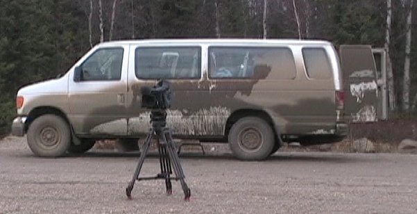
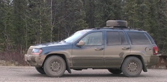
"Latitude Line" was
from the company that was there when I arrived - One van and one Jeep.
They were filled with folks from France who were here filming
a
show on Alaska (folks - e-mail
me with any corrections).
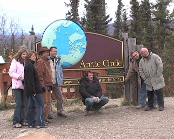
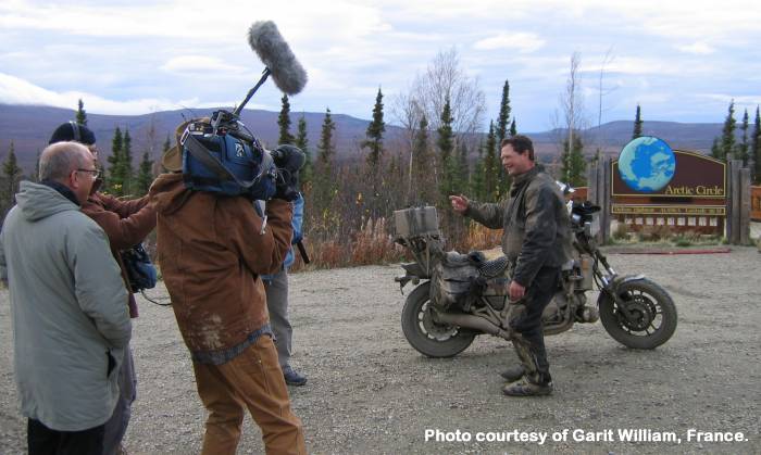
The muddy guy on the mud covered motorcycle garnered some
attention from the cameraman and his camera. We all had a
good
time. Perhaps you'll also see me on TV somewhere.
From here
they were heading North then at some point a flight to Barrow, AK. They
have a picture or two of me and are going to e-mail it to me -
I'll update this page when I have items from them. I also
have
some
minor video footage for them - original footage available if they wish
it.
edit 2006-04-01 : Some time back an e-mail came to my email box commenting on "seeing me on TV" I assumed some sort footage of me made it into their show. With an e-mail to Garit William (who e-mail exchanged some photos with me) he graciously dropped a DVD of the show into the mail - gratis. I am grateful to him for doing this for me. It is fun to see yourself on TV (since it is rare). It was also good to watch their show. The footage they have is fantastic. Several of the spots they filmed were spots that I visited (Hey, I've been there too! I know just where that is!). I didn't understand much of it (I should learn some French) but Alaska is a photographic jewel to which they imparted a smooth polish.
In the past many weeks I've assembled some links to their website regarding the Alaska show and the discussin forums they have.
Links and PDF archives
Alaska: French, Google translation to English, PDF FR, EN
Forum 1: French, Google translation to English, PDF FR,EN
Forum 2: French, Google translation to English, PDF FR, EN
Their driver, from Chicago, commented that they'd see me that evening in Coldfoot - 60 asphalt miles up the road. I gave serious contemplation to this egging on. Do I head up to Deadhorse/Prudhoe Bay - the whole trip? Do I head back now? Do I head to Coldfoot for the night and then head back? I decided to head back now - this would put me back after dark (I'm trying to be off of the roads near dusk to reduce the odds of an animal collision) but there was talk of snow coming the next day or so.
I would like to see the mountain range (Brooks Range) that is between Coldfood and Deadhorse but with the cloudy weather I probably wouldn't be able to see them - I need to return in the summer with (better odds of) clear skies. A plus would, hopefully, be dry roads. The general comments being the wet, muddy travel is near the worst. I think snow or ice may be worse - but this mud certainly is no fun.
edit 2006-04-01 : Some time back an e-mail came to my email box commenting on "seeing me on TV" I assumed some sort footage of me made it into their show. With an e-mail to Garit William (who e-mail exchanged some photos with me) he graciously dropped a DVD of the show into the mail - gratis. I am grateful to him for doing this for me. It is fun to see yourself on TV (since it is rare). It was also good to watch their show. The footage they have is fantastic. Several of the spots they filmed were spots that I visited (Hey, I've been there too! I know just where that is!). I didn't understand much of it (I should learn some French) but Alaska is a photographic jewel to which they imparted a smooth polish.
In the past many weeks I've assembled some links to their website regarding the Alaska show and the discussin forums they have.
Links and PDF archives
Alaska: French, Google translation to English, PDF FR, EN
Forum 1: French, Google translation to English, PDF FR,EN
Forum 2: French, Google translation to English, PDF FR, EN
Video
Alaska - Arctic Circle at the Dalton Highway
2005-09-22-arctic-circle-tv3.mpg
MPG, 18.5 MB, 2 min 21 sec
Alaska - Arctic Circle at the Dalton Highway
2005-09-22-arctic-circle-tv3.mpg
MPG, 18.5 MB, 2 min 21 sec
Their driver, from Chicago, commented that they'd see me that evening in Coldfoot - 60 asphalt miles up the road. I gave serious contemplation to this egging on. Do I head up to Deadhorse/Prudhoe Bay - the whole trip? Do I head back now? Do I head to Coldfoot for the night and then head back? I decided to head back now - this would put me back after dark (I'm trying to be off of the roads near dusk to reduce the odds of an animal collision) but there was talk of snow coming the next day or so.
I would like to see the mountain range (Brooks Range) that is between Coldfood and Deadhorse but with the cloudy weather I probably wouldn't be able to see them - I need to return in the summer with (better odds of) clear skies. A plus would, hopefully, be dry roads. The general comments being the wet, muddy travel is near the worst. I think snow or ice may be worse - but this mud certainly is no fun.
And the tail end of "my 60 seconds of fame" shows my picture being taken....
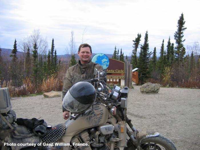
Rounding the parking lot a time or two for their footage.
I'm getting more covered....
In the left portion of the picture is a hill/mountain. A cloud bank was rolling over it and moving to the right.
The bike's not too badly covered in these pictures.
The firetruck also gets a few questions "What's the deal with that?" Ask Fire Chick...
This was a forced picture stop (I wanted to keep moving - nightfall is coming).
With the dirty conditions the cameras were tucked away and thus there are few pictrues today.
Panorama
(click for a larger version)

Alaska Pipeline, Dalton Highway (asphalt section south of the Arctic Circle)
Noted in this picture is the road and pipeline in the distance - the road is on the right and the pipeline is on the left, buried.
122 miles on the clock since leaving the river the first time. I'm back down by the water, after fueling up, getting water to hose down the radiator. It was nowhere near as plugged up at the Arctic Circle or here than the first time. The road is drying out and I'm able to run in the dryer, packed tire tracks. I only sprayed it with three or four bottles this time.
Looking upstream
Turned around - looking downstream
Now for 51 miles of dirt, with that 2-4 mile section of asphalt rest / teaser tossed in, then 84 miles of asphalt Elliot highway and asphalt route 6 to the Old F.E. Gold Camp at Chatanika.
I made it back to asphalt without dumping the bike - though there was one slow speed wobble / weave in the muck that had me wondering and working. I got used to the general side slips and handlebar wiggles that happened all too frequently.
One nice end point was some decent rain for the last 40 miles or so - it did at least a little bit to wash me off. I still had to shed the outer layers and leave them outside the building.
I started at 11am (late) and arrived back just before 11pm.
