Luke & the "Yellow Wing"
03 Nov 2002 - Sunday
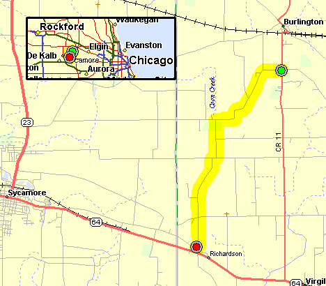
Temps are in the low 40's with mostly overcast skies. I met up
with Luke for lunch at Sycmore IL. After lunch we road up McGough
Road. It differs a bit from depicted on the map - this is a through
road with no stops between the route markings. Each turn is a nice
sweeper.
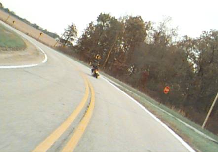

A bit later - on the way back home - Walker Road North of S.R. 72 (West
of Hampshire):
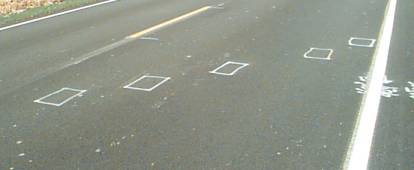
Anybody know what these markings are for? (e-mail
me from the main page)
They are seen on new asphalt roads. Most common are boxes - almost
always five of them on the diagonal. Sometimes 1/2 boxes (L shapes)
are used and rarely are oblonged circles used. The markings are such
that the paint wears off after a short period of time. Are they to
mark imperfections? To mark where one asphalt batch / truck emptied
and another started?
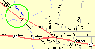
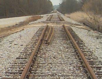
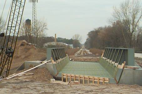
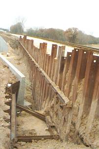
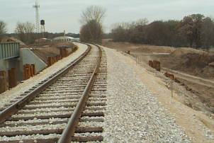
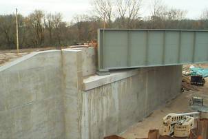
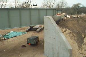
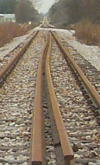
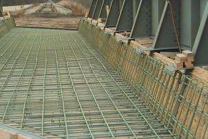
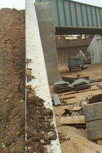
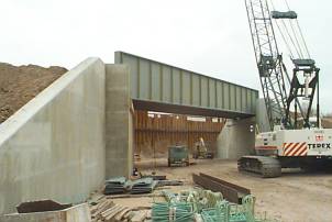
Then on over to the road / R.R. bridge construction site in Genoa. The old underpass / bridge was a tight S curve with a center median / support. The new bridge will allow for a straighter, wider, no-center median underpass. To allow for train traffic to run during construction the road was closed to all auto traffic and a bridgeless R.R. bed was constructed. To keep the tracks at their desired level a bed 10 to 15' above the surrounding ground level was needed. To create this elevated re-route steel 'walls' were driven and then filled in between. Some of the pictures show the re-route with cuts in the straight sections of track. When the job is complete the re-route will be removed and train traffic will again pass straight through. Unlike the map - which shows a siding - there has been no siding at this location for some time. Single track operation.
The roadway used to pass from the left to the right - way over by the
white construction wagon. Over by the white wagon it would have a
tight S under the railroad tracks.
(click image for a larger view)
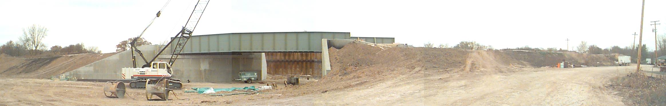
Standing at the right of the new bridge (as from above) looking down
the tracks. The first 'cut' in the tracks was where the old bridge
was (now removed and the area filled). The second cut is where the
tracks are re-routed around the construction.
Turning around looking W/NW.
One of the steel walls, filled with re-route tracks on top of the fill
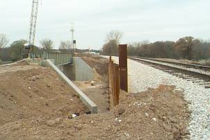
The re-routed tracks - note a shorter fill wall (5 to 10') on the right.
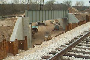
Still more work to do
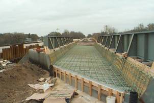
Victor is this one of the wing walls you were talking about running
up?.
Victor is a buddy who is a carpenter that made the forms for the concrete
work.
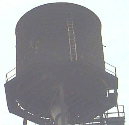
Just West of the construction site is this old water tower (which I
believe is still in use). I had to stop when I noticed the hardware
store aluminum extension ladder - extended out to its maximun extension
- resting way up there!! A couple ropes (with a generous amount of
slack) kept the ladder from being blown off of the tower. Anyone
care to volunteer a climb??
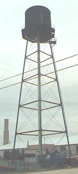
This is an OLD water tower in fairly poor condition - note the piece
under the center of the bucket that is cocked on an angle - it's
not supposed to be like that.