A Sunday afternoon ride
|
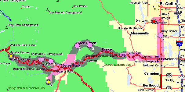
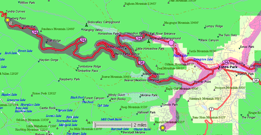
The weather is a treat on this spring day - why not head up to the Rocky Mountain National Park and see what things are like? I wish to thank Diann White and Mark Melin for the gift card - it came in just right for fuel in the car and my stomach! This page has three sections. The first are views as I was entering Estes Park from Glen Haven. Second was a stop (yellow dot #4 on the maps) at the east portal of the 13.1 mile long Alva B. Adams water diversion tunnel (the C-BT water project). Last are many views from US-34 as I drove from Estes Park up to RMNP. The road was still closed for through traffic (snow clearing operations yet to complete). It is still early in the season for traveling about the park. Above 8 or 9,000 feet snow can be found. Bear Lake is still 95% frozen. I did walk "around" the lake though a good portion would be considered "on the lake" as the trail was too snowy. |
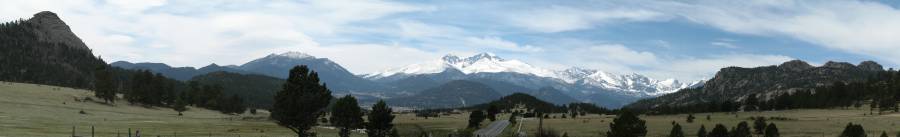
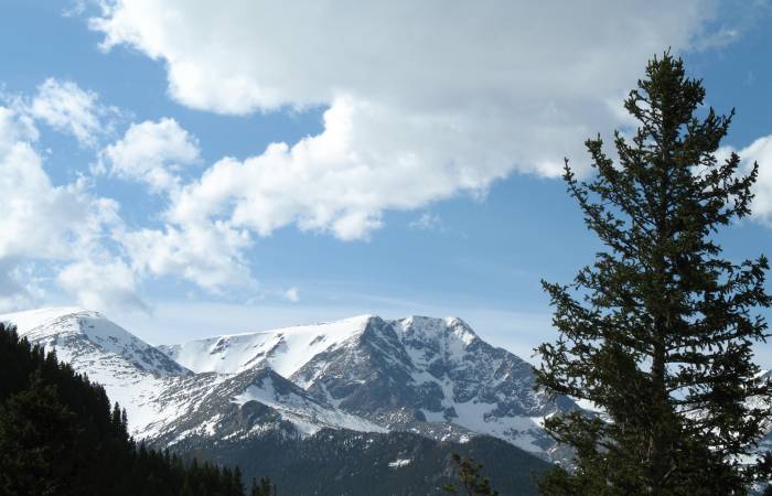
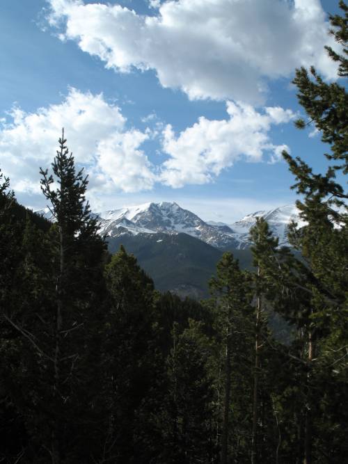
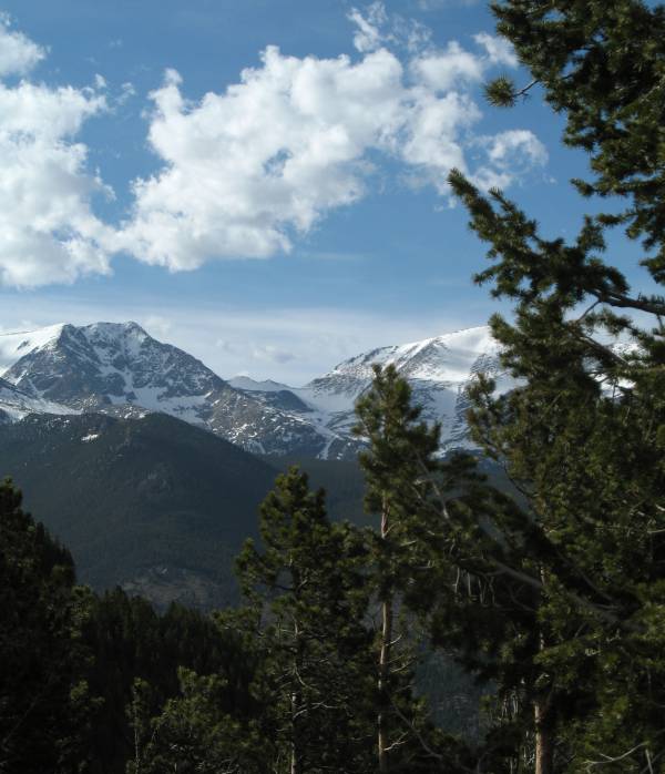
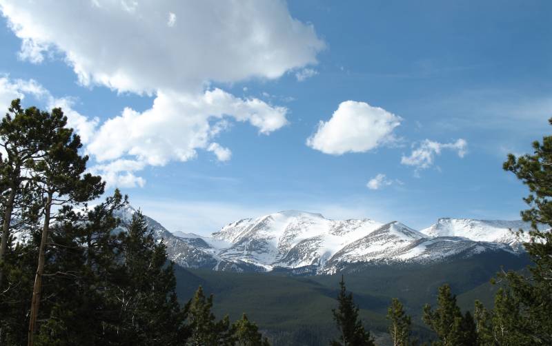
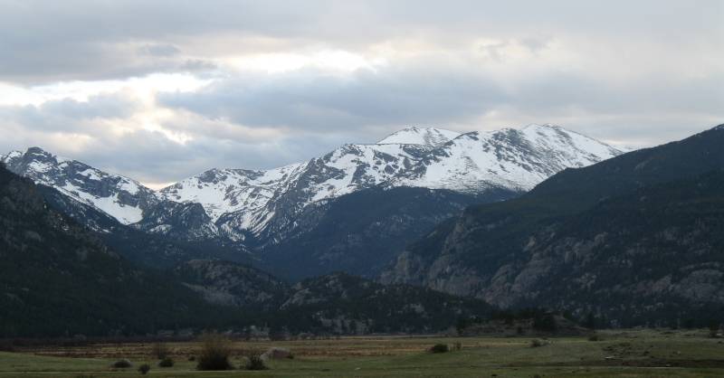
| I have said before - this view is a favorite of mine. The trek from
Glen Haven to Estes Park finds us traversing up a couple sets of
switchbacks to the pass. As we poke over the pass we're presented with
this wonderful vista. Panorama (larger size) Remember, when you click on a "larger size" photo notice if your web browser automatically shrinks the photo to fit your screen. You might need to click on the resulting photo to expand it to full size. Many are significantly larger such that you should likely have to scroll right-left to see all of it. |
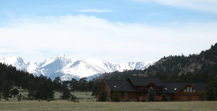
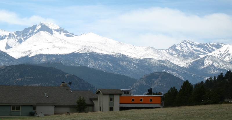
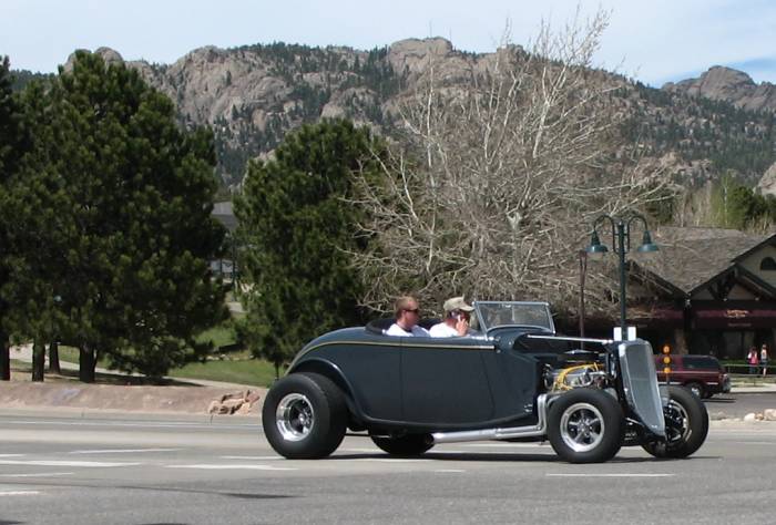
| This home has a distinct railroad theme. Crossing lights along the driveway, a caboose in the yard. |
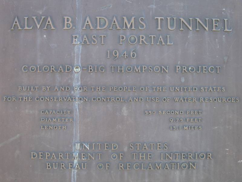
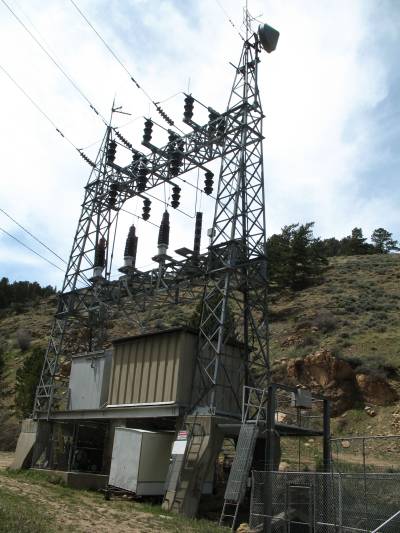
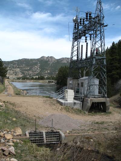
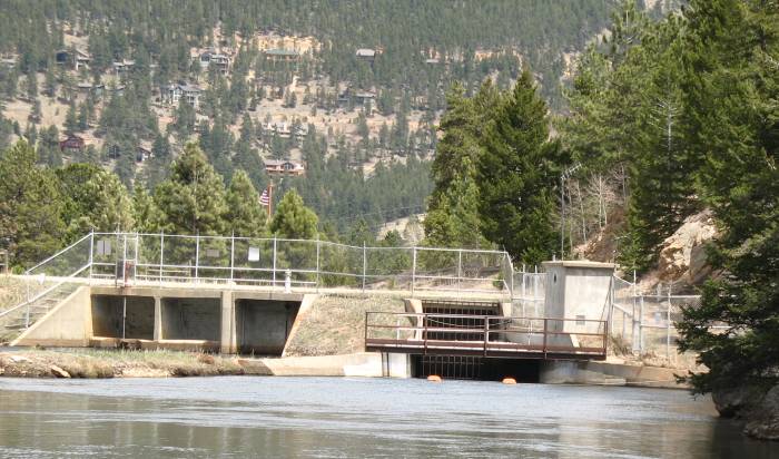
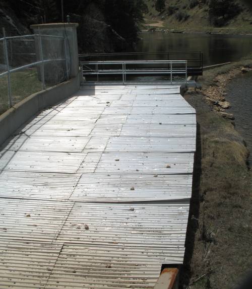
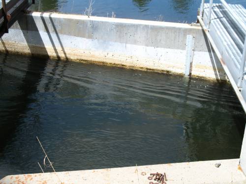
The reservoir at the east portal of the Alva B. Adams tunnel. The CBT (C-BT) project is a water diversion project that is named for two rivers primarily involved, the Colorado River on the western side of the Continental Divide and the Big Thompson on the eastern side of the divide. The goal is to store and move water on both slopes of the mountain range for use along the growing eastern slope. Agriculture was a driving force as the land was able to produce crops though consistent, reliable water was needed. With eastern slope reservoire projects completed (used to store spring run-off of the eastern slope waters), residents looked to ample water on the western slope as the next step, but how to move it from one side of the mountain range to the other? Enter a 13.1 mile long tunnel (just under 10 feet in diameter) through the Rocky Mountains. While gravity is the prime mover of the water, there are two spots on the western slope where water is pumped UP and one spot on the eastern slope that is a "reverseable" route - water mainly falls down a pipe though, if needed, water can be reversed and pumped back up the pipe for re-distribution. The reservoirs play as large a key in the project as the water itself. The need is to spread out the spring run-off so that it can be released as needed through the whole year. As the water descends the elevation it is used to generate electricity. There are about three (that I can think of) power generation stations along the CBT's eastern slope. These stations are often used for mid-summer-day peak power needs. If you wish to learn more of this interesting project - pick a search engine and type in "Colorado Big Thompson project". |
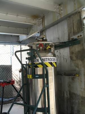
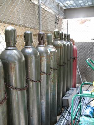
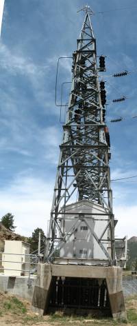
| While there is no power generation at this east portal reservoir, power is involved. These power lines go into the water tunnel, inside Nitrogen gas filled pipes suspended from the ceiling of the tunnel, for use on the western end. |
| One of the Nitrogen tanks. You can hear the gas moving so there must be either a gas vent at the other end or leaks in the piping. |
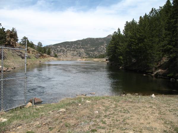
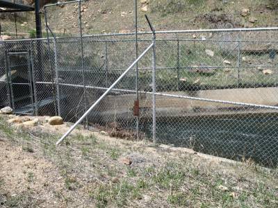
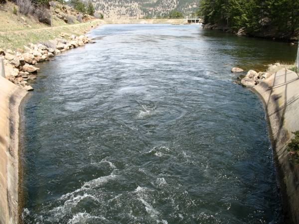
| In the bottom left of this photo are two gates. These gates take in the "Wind River" (more like Wind creek). The natural water passes under the man-made, controlled water reservoir and exits back into its natural path just down hill. |
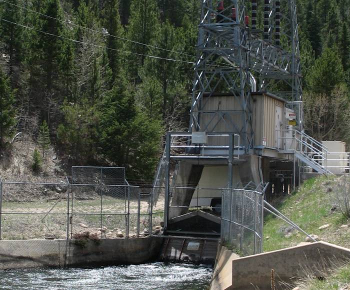
| The three openings, left, are the spillway for the reservoir. If excessive water does enter (rainstorm and up-hill run-off?) it would spill out and down into the Wind River. The dark opening to the right is where most (all?) of the water goes... another tunnel (possibly Rams Horn Tunnel). |
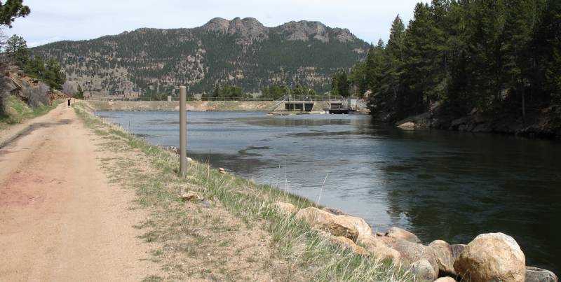
| Video Moving Water east-portal-water.wmv WMV, 840 KB, 12 seconds Finished with the East Portal reservoir we're looking towards Estes Park. I'll jump into town and pick up a sub sandwich to eat at some nice vista stop. |
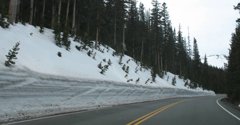
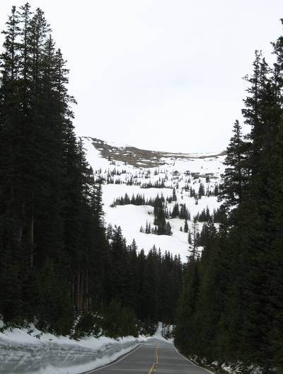
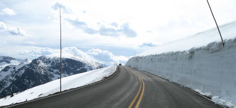
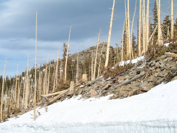
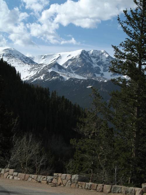
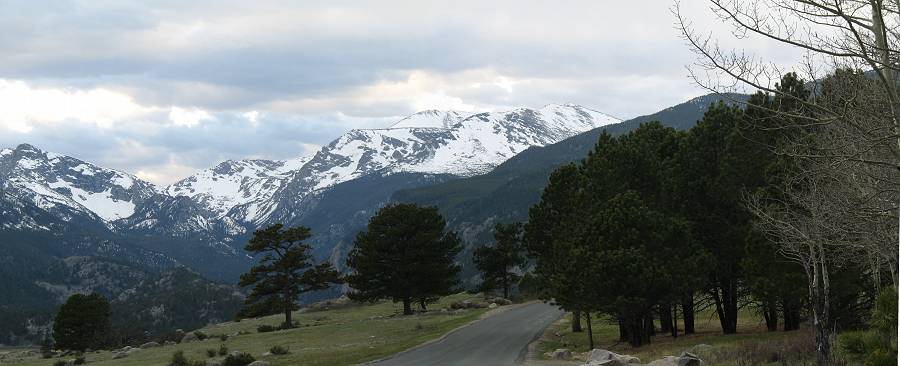
| Heading west on US-34 somewhere about 9000 feet above mean sea level. Areas still have a fair bit of snow. |
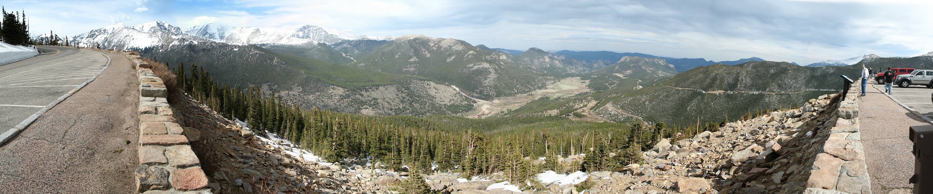
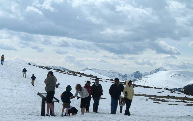
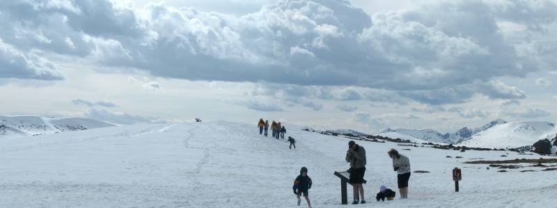
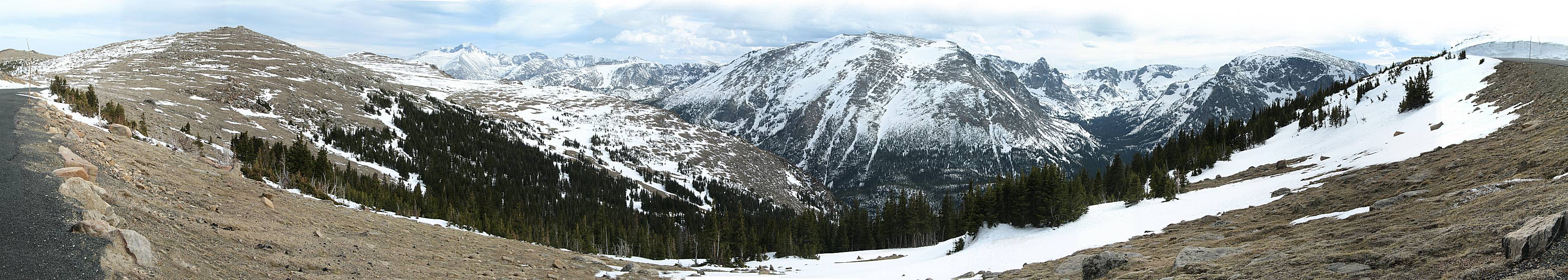
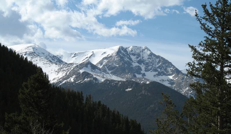
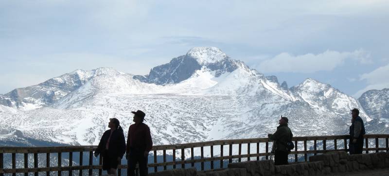
| It was a fun day at the overlooks / vista points.
The parking lots (and road) weren't stuffed with visitors and the
people that were there, to my surprise, were mostly from
interesting tourist places. California, Florida, Southeast Asia,
Russia. I took group photos (with their cameras) for several groups.
Always fun to help out and hear their story. Panorama (larger size) |
| Estes Park is in the valley just beyond the first mountain. The fuzzy, light horizon is the flat eastern plain - about 25 to 30 miles away. The eastern plain is at 5000 feet elevation and this overlook is slightly higher than the "You're two miles above the sea" sign (5280 feet in one mile). |
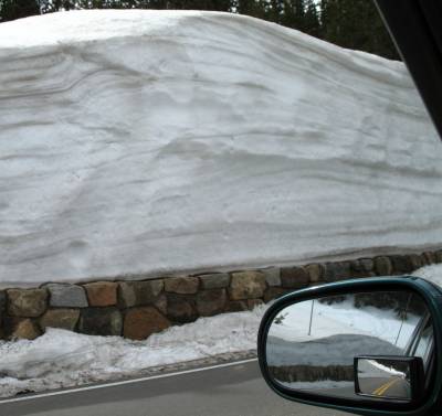
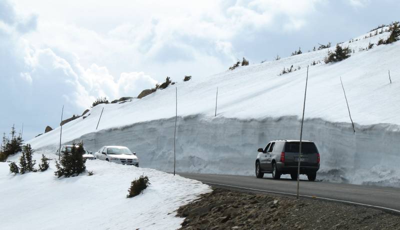
| This photo does make me think - "what if" a good chunk of snow on the right were to sluff off as a car passes by? |
| Hmmmmm.... |
| Panorama (larger size) |
| Yep - people in shorts. I was happy to wear a coat (the wind was really kicking) though without one was OK-ish. |
| Panorama (larger size) |
| More roadway marker "snow sticks" |
| Panorama (larger size) |
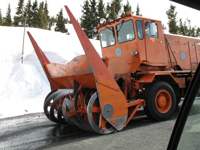
| One of the snowblowers. It would be interesting to watch for a bit as they work. |
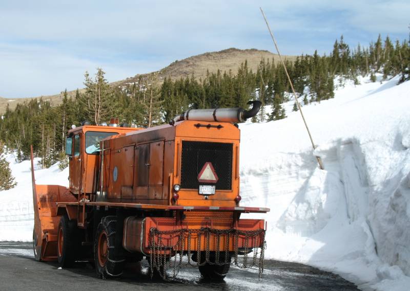
| Snow sticks in the making. |
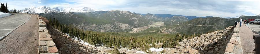
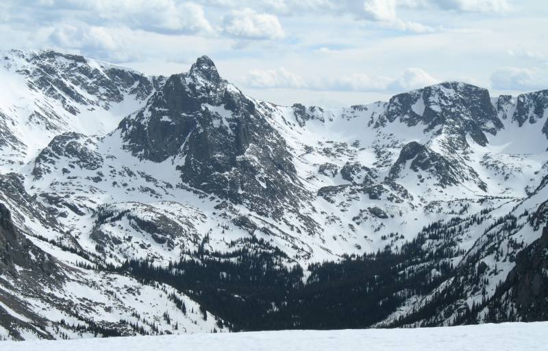
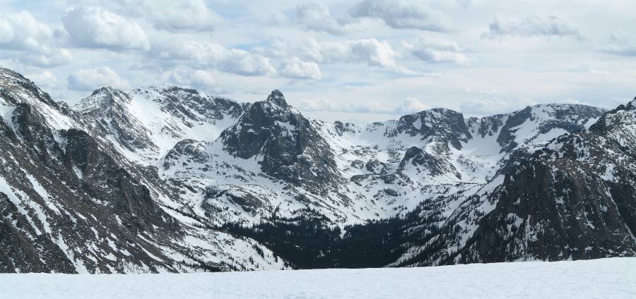
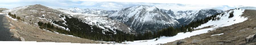
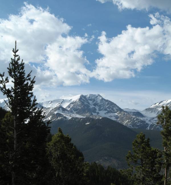
| OK, sorry for this one view with too many photos - I can't decide. |
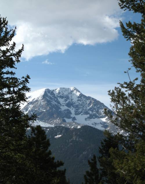
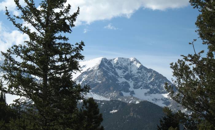
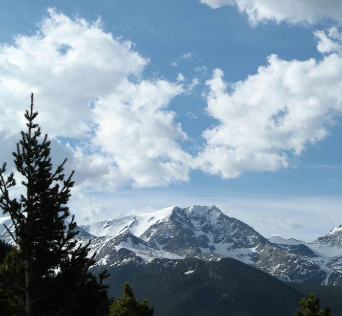
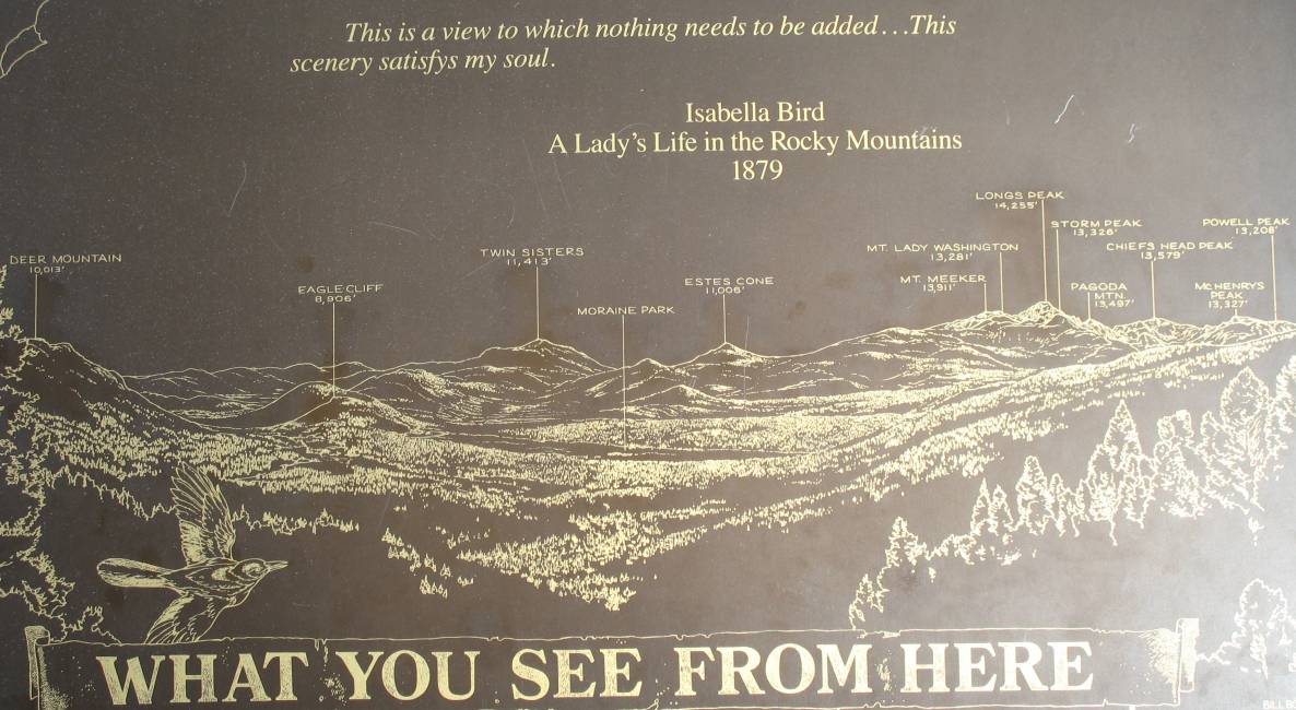
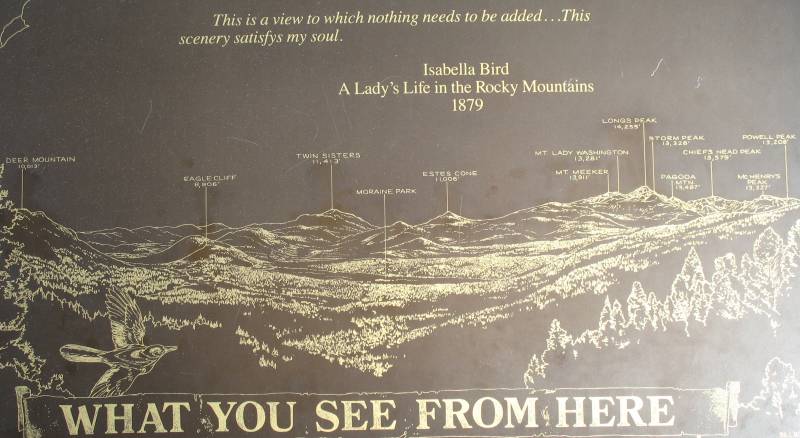
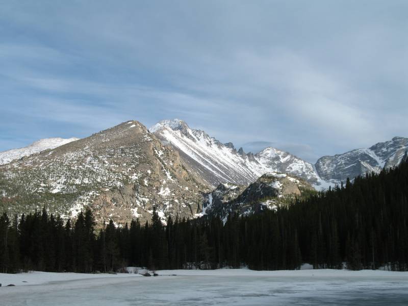
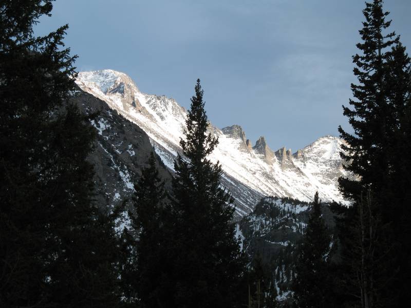
| While I took a photo of the scenery description I
didn't pay much attention to aligning a photo for it. I think the tall
peak in the above photo is Longs Peak. You can find it on the below
description. (larger size) |
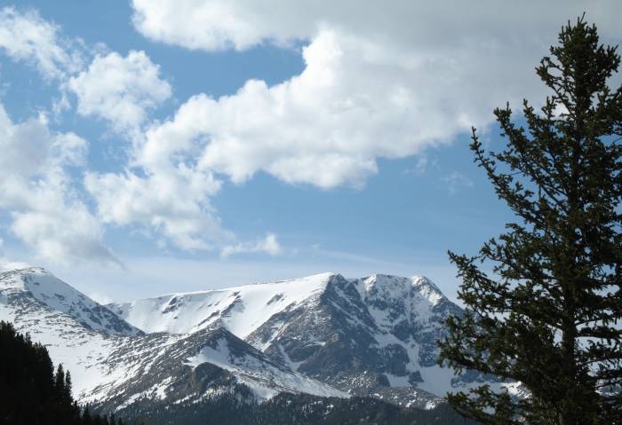
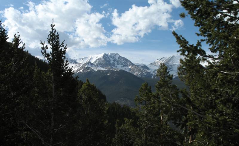
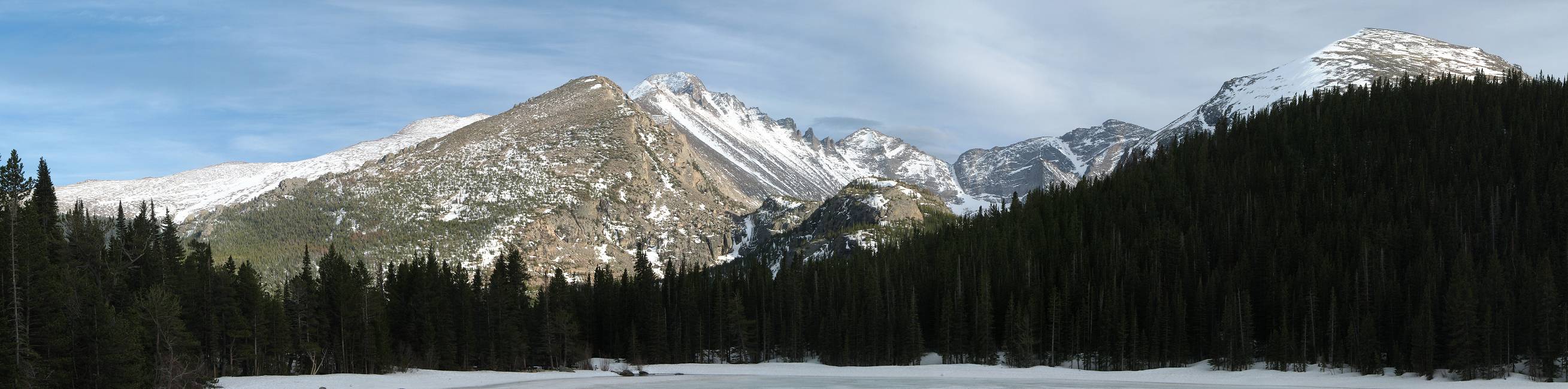
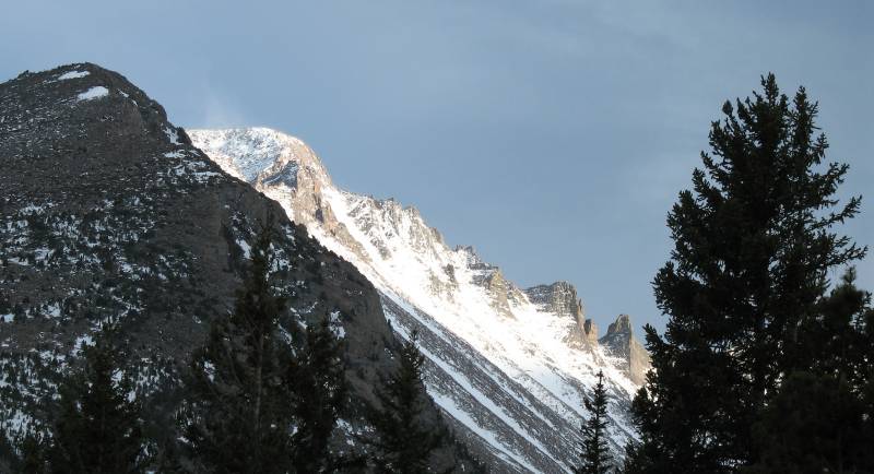
| I like the solid uniformity of the green pine tree forest as it flows up to the white snowcapped peaks. |
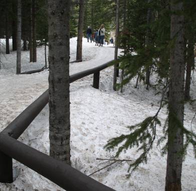
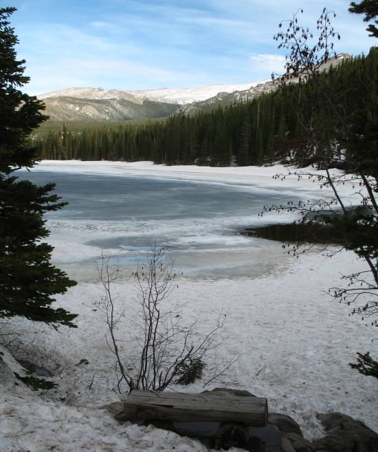
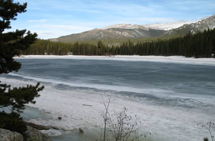
| The walkway / entrance to Bear Lake. Perhaps three feet of snow remaining on the path. |
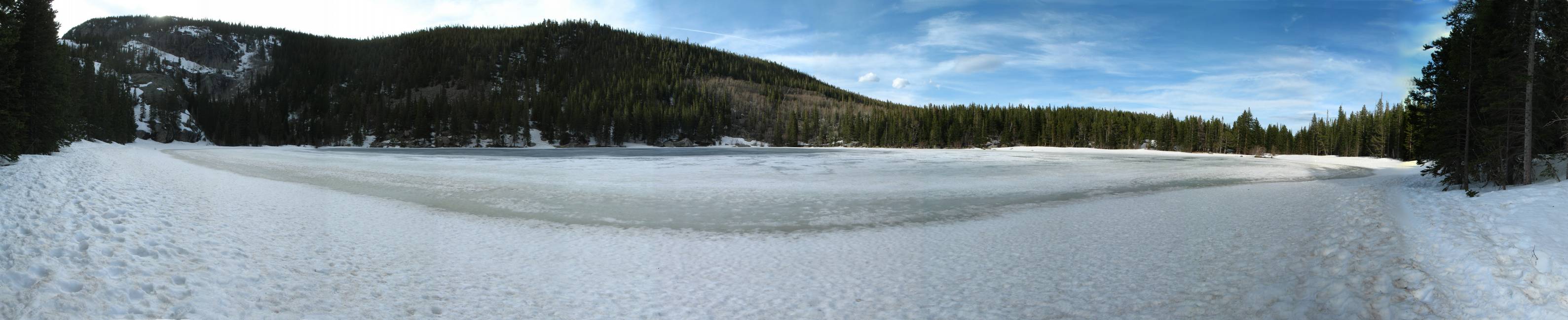
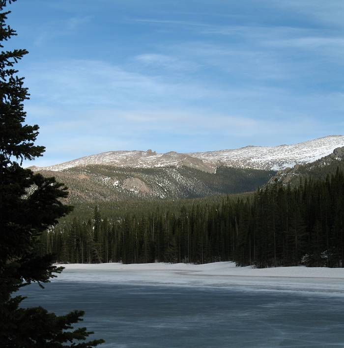
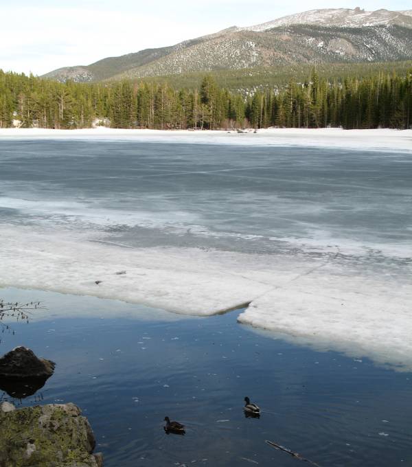
| And one rather frozen lake Panorama (larger size) |

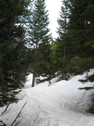
| On the south side of the lake (to the right and far left in the above photo) I walked on the lakeshore. The path, below, was in the trees and well snow covered. The north side of the lake was not as snow or ice covered. |
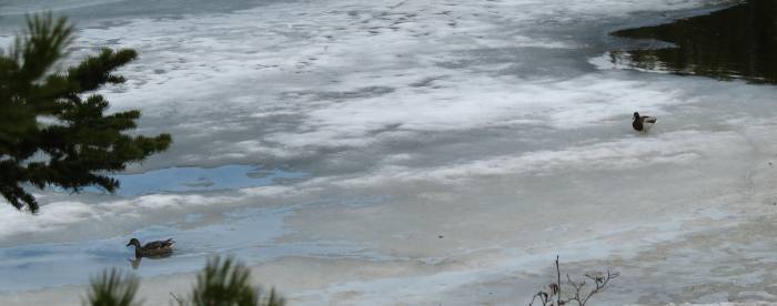
| Mama & Papa duck working their way from one un-frozen section to another. |
| Panorama (larger size) |
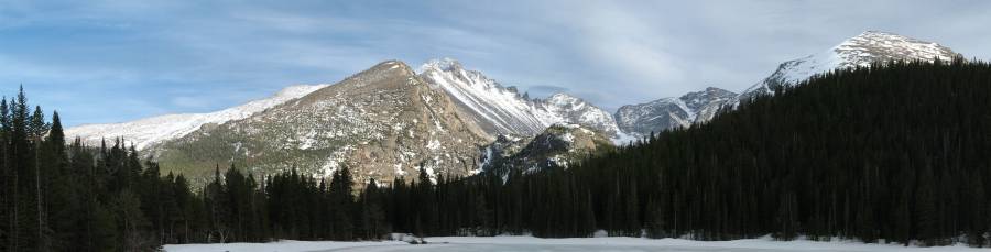
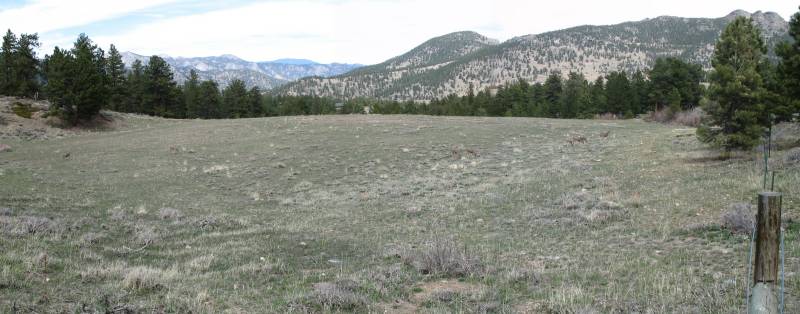
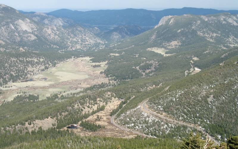
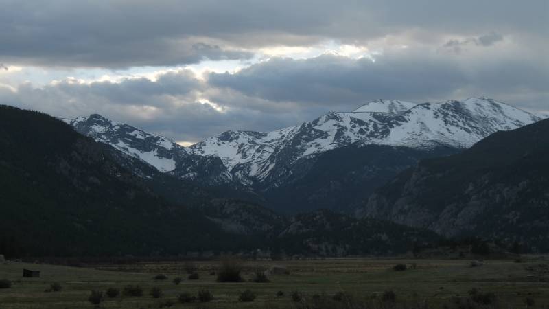
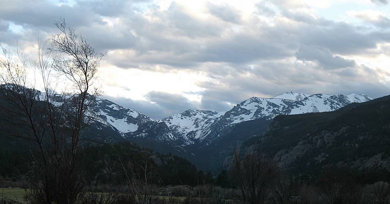
| Moraine Valley |
| Panorama (larger size) |
| Panorama (larger size) |
