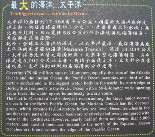
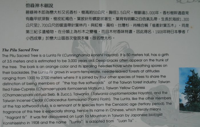
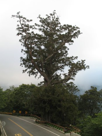
Yesterday
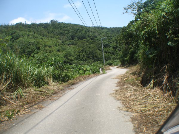
I followed the "inland" route from my start to Hualine. This was due to
two reasons - wanting to check out the Southern Cross Island Highway
and to make time. If I hadn't spent so much time on the CIH I could
have bopped back out to the coastal highway. Wanting to get to Hualine
before dark I decided to stay on the inland, valley highway.
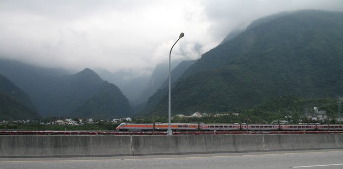
Once
or twice I saw some trains - one of them was going my way, close to the
highway, and the highway was straight - Hmmm - how fast is it running?
WOT and the cars still keep passing me up. Soon they aren't passing me
by as fast and about the time the last car crept past me the tables
turned and I was creeping back up on it - 102 kph (GPS). It was still
kicking along as I eased back to the 50 kph speed limit.
So,
you're thinking "what about the police" - well, they do exist as does
the military. Out on the Penghu Islands the military seemed more
"common" - bases and uniformed persons - either commuting to or from
"work" or standing guard at a gate. Over here on mainland Taiwan
military jets are more common (though you did see from a day or two ago
some bases in the hills).
The police are about - either cruising
with their lights off or often with their lights on. I passed one or
two "checkpoints" - a squad car or two at the side of the road and the
officers out standing looking at traffic. The have never given me a
second look. I often wave or nod and they do the same in return with a
smile.
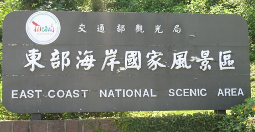
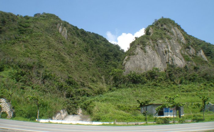
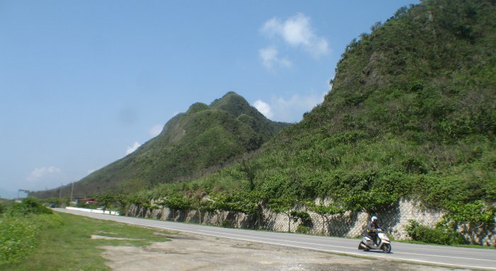
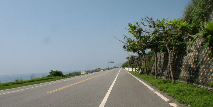
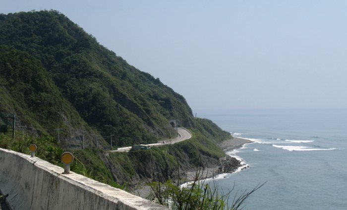
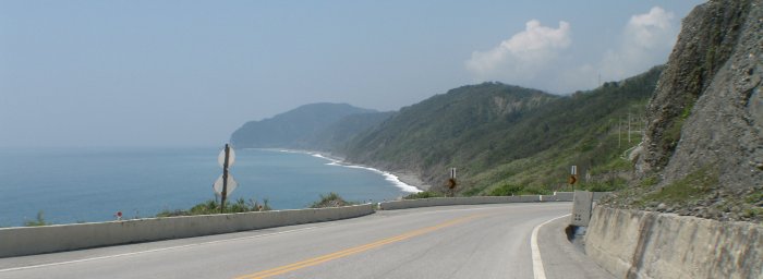
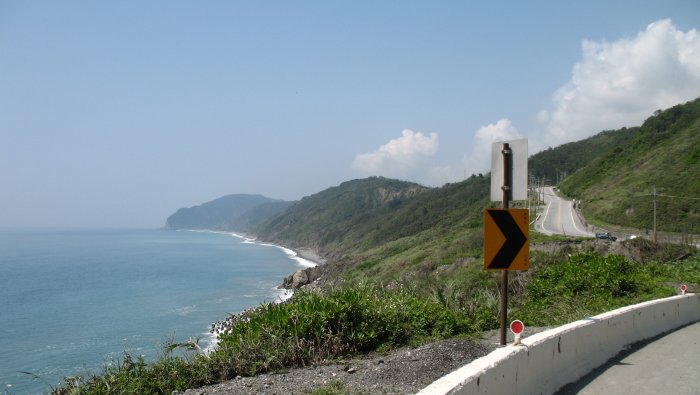
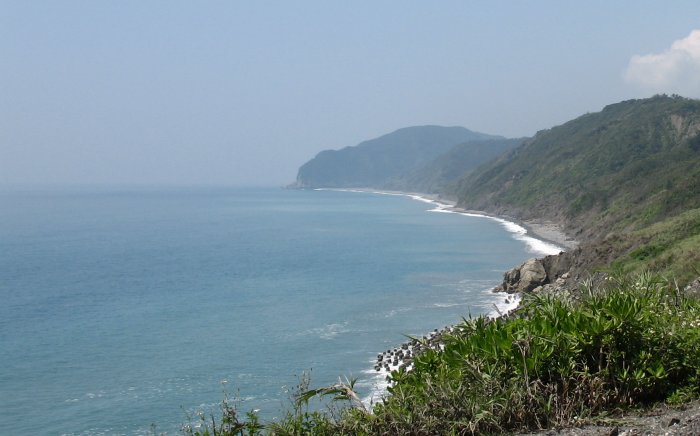
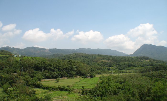
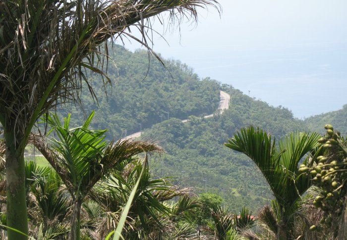
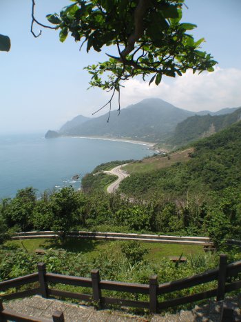
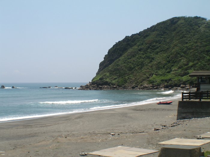
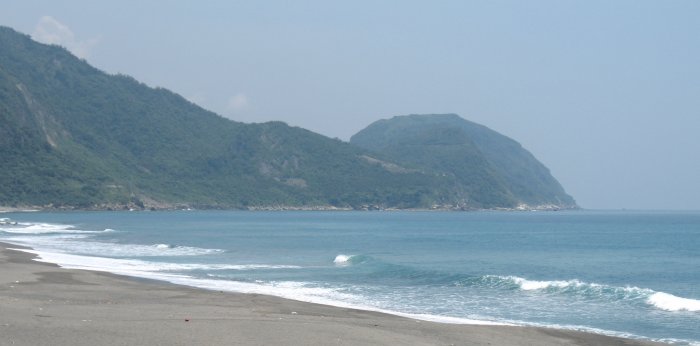
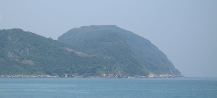
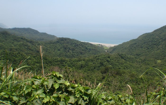
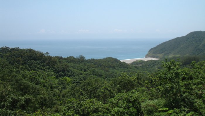
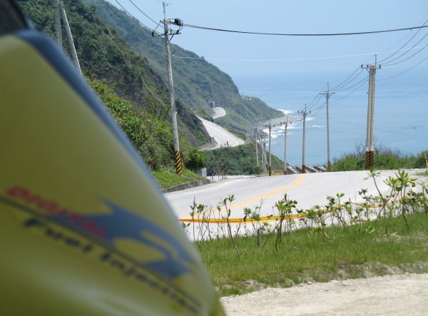
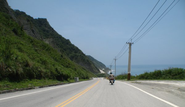
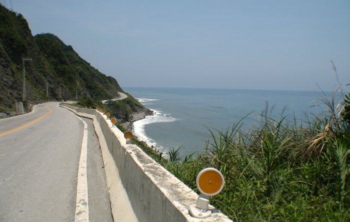
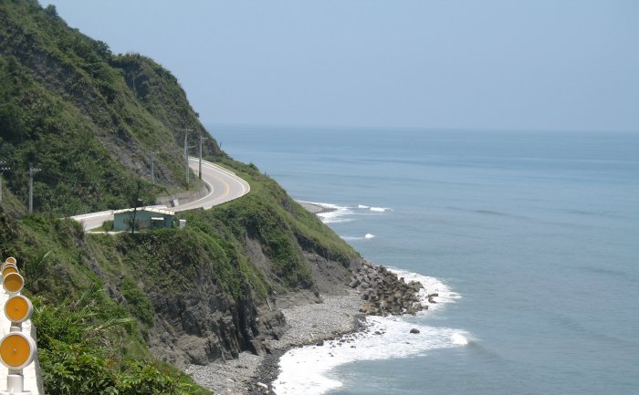
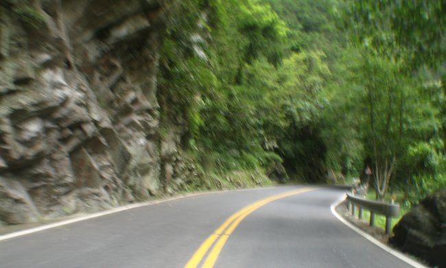
Anyway, since I took the inland route to Hualine
yesterday I wanted to see some of the coastal highway sights south of
Hualine. So, in the morning I headed south a bit to check things out.
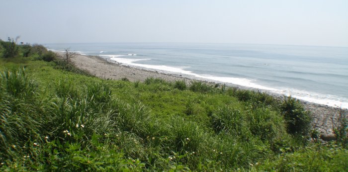
Grand sights. I was planning on taking 30 minutes to head south and
about the same time heading north (I anticipate fewer photo stops on
any "return" or backtrack leg).
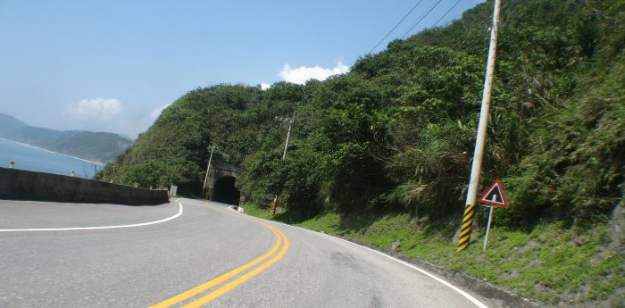
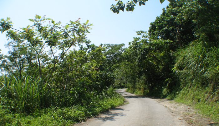
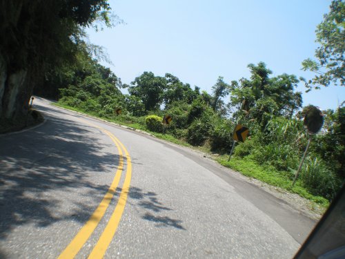
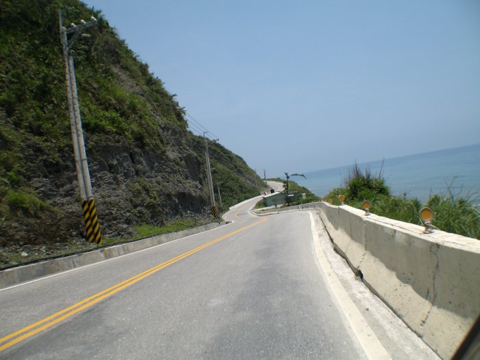
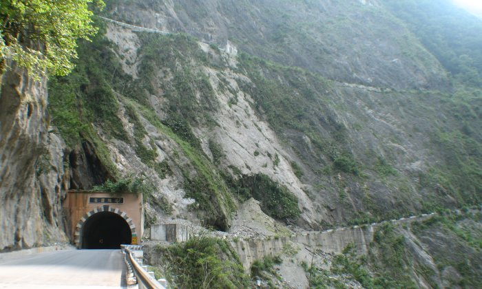
Bottom line - I took longer than
I expected - full well knowing the Taroko Gorge trek was a day event in
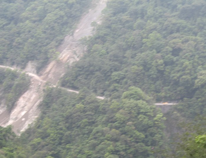
itself. Sections of this highway are undergoing changes - more tunnels
being built and as such the road won't snake along the hillside with a
view to the beauty to the east - just a dark tunnel through the rock.
If you have any thoughts of visiting - soon is better though there is
so much an extra tunnel or two won't impact significantly.
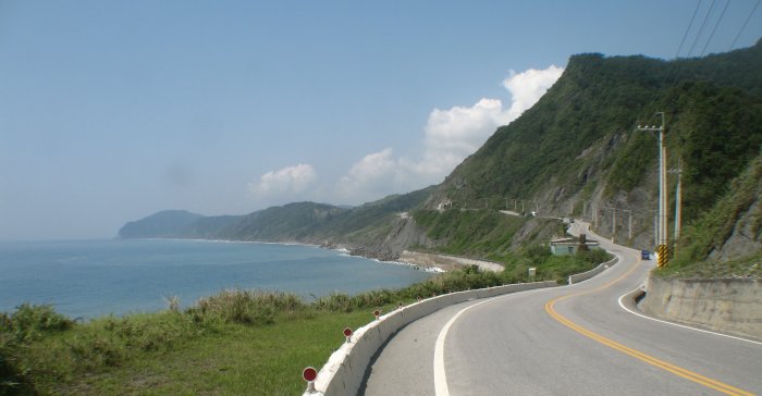
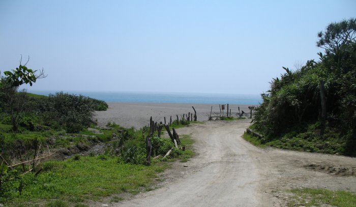
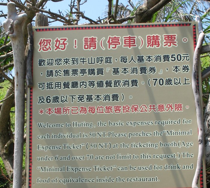
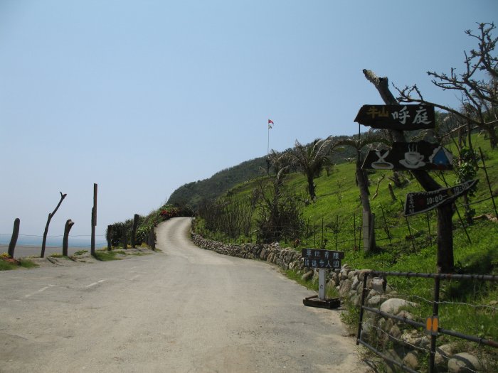
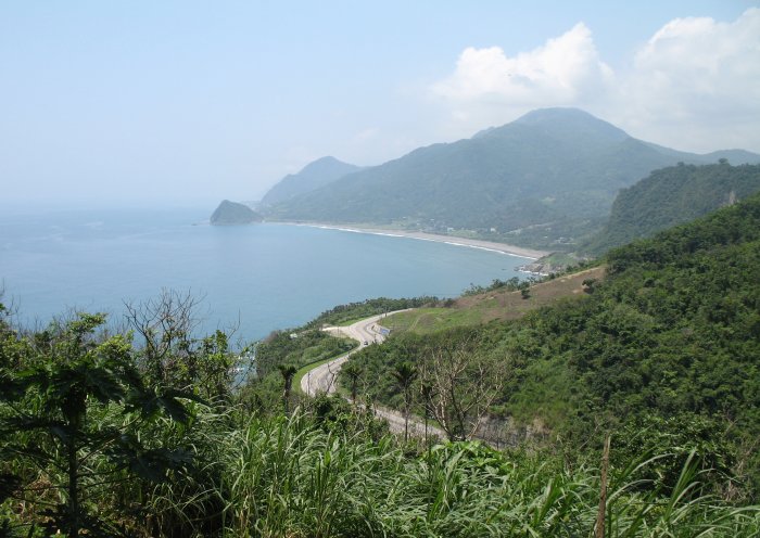
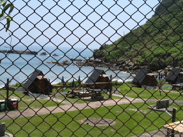
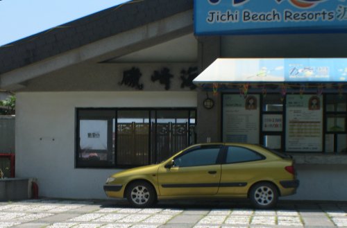
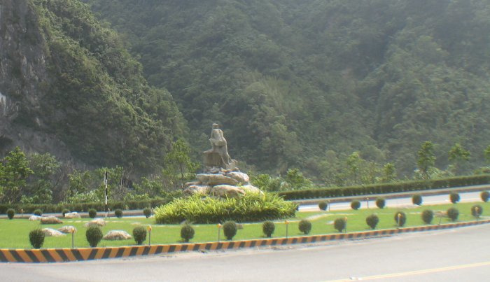
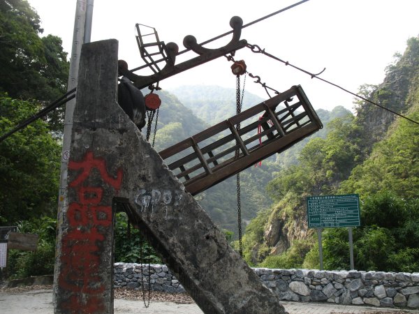
My
turnaround point was this "resort" - somewhat in line with my feeling
of Taiwan that improvements are constructed (buildings, info signs,
vista points) and they they are little used and often little
maintained. This resort was that - built up - and it looked decent
enough - but it was sitting near vacant. Parking for 100 when only 2
are used. To top it off this beach was "the resorts" beach. It was
gated off, fenced off, and barb wired off. Goofy - right up near the
building was a "section" where a person could hop into the "resort" so
they strung some barbed wire to prevent it - certainly looked out of
place and certainly gave an un-appealing look to the place.
Anyway, they didn't mind me turning around or poking the camera through the fence to get a shot or so of "their beach".
Back
through Hualine and a stop at MickyD's for a fish, some corn, and some
OJ (orange juice). Heading out of town I stopped for some fuel and off
I go. I notice the "Oil Change" indicator flashing. Felipe says he gets
oil changed every two weeks (in the amount of kilometers he normally
travels). It flashed for a change a couple days before I left Penghu /
Makung. I made it about five days with the amount of driving I'm doing.
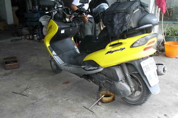
Not
more than 3 minutes later, over to my right, I passed by a Yamaha shop.
Knowing how fast it took for the last oil change I turned around and
rode back, at the far outside of the roadway, against traffic. The
owner came up and I pointed to the "oil change" indicator and he got
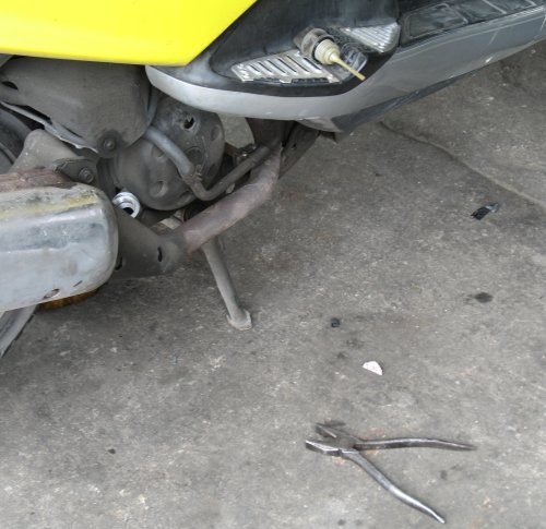
right to work. Out came the drop pan. The drain plug wrench was sitting
on the ground nearby - out the hot oil came. While that was draining he
went to his tool shelf and pulled out a linesman's pliers, went over to
the right side of the bike, and twisted off the fill/check cap. This
act greatly interested me as I've tried twice to check the oil level in
the bike - never knowing where the fill / dipstick item was. The item
on the right certainly looked right but I could never get it to budge -
and now I know why. It must be standard practice to wrench-tighten the
fill / dipstick cap.
That task done - 250 NTD - about $8 US
- his wife said something and he acted upon it (I had showed him
my map and outlined my travels with the bike). What'd she say? "Check
the air in the tires" - in a language I couldn't understand - but when
he pulled the tire gauge off of the shelf, hooked it up, and went to
each tire - adding some in the rear, letting out just a little in the
front - it was obvious what transacted.
I asked if I may take
his photo (I've not spoken a word mind you) and he smiled and shyly
waved me off - fine enough. I backed out, started up and toot-tooted
the horn and waved a good wave. Onward to Taroko Gorge!
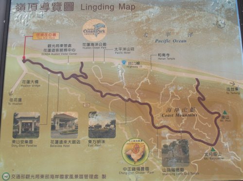
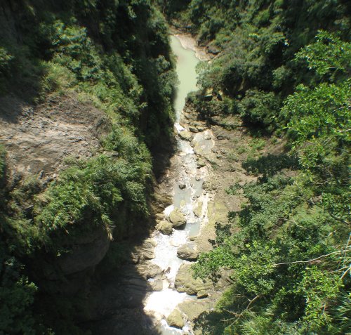
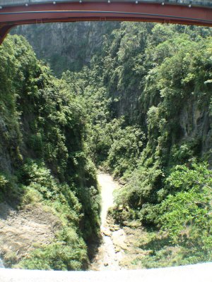
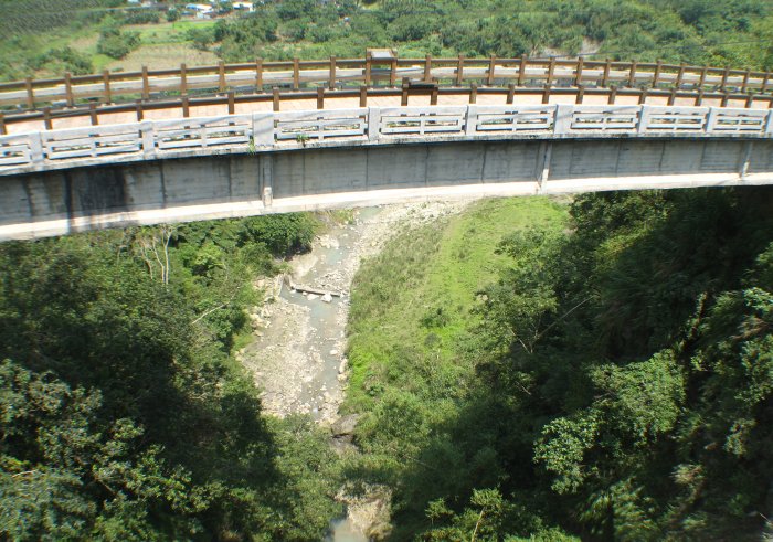
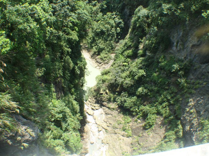
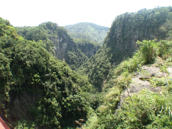
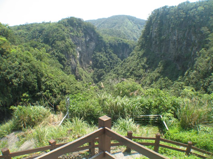
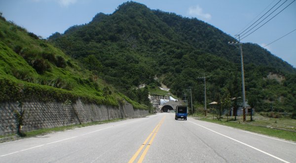
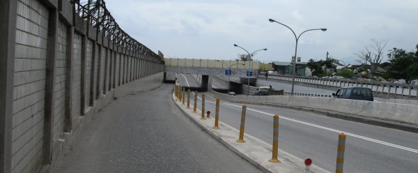
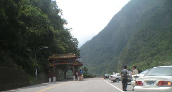
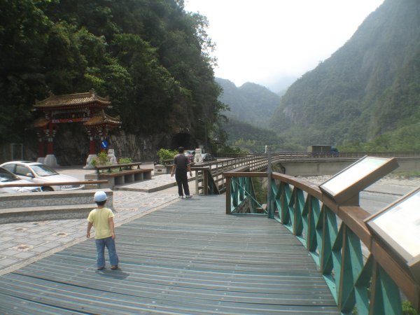
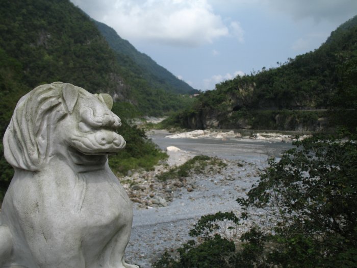
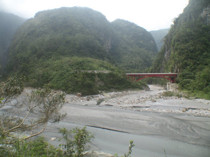
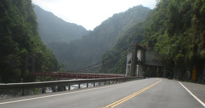
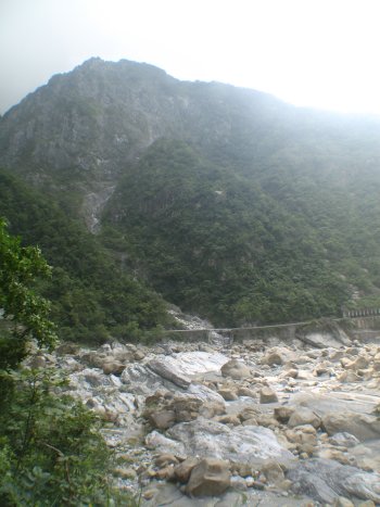
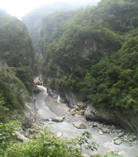
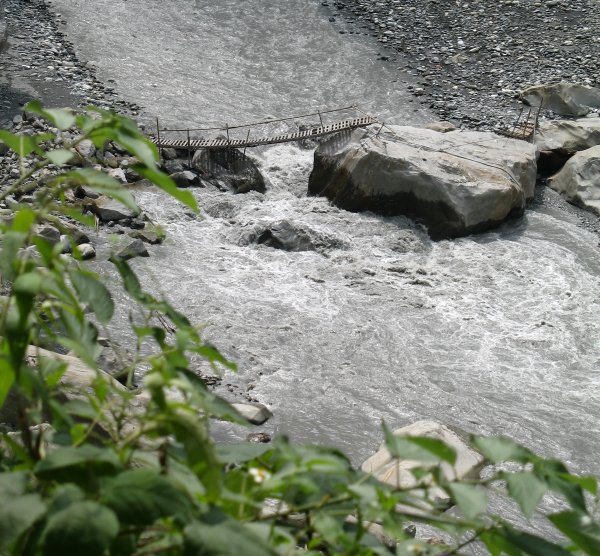
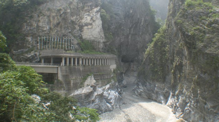
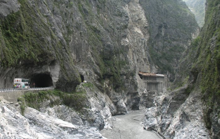
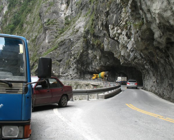
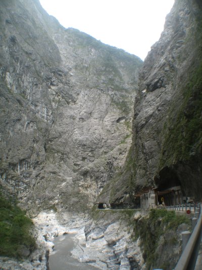
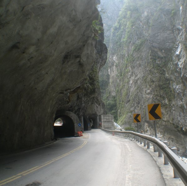
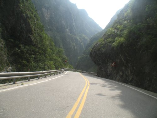
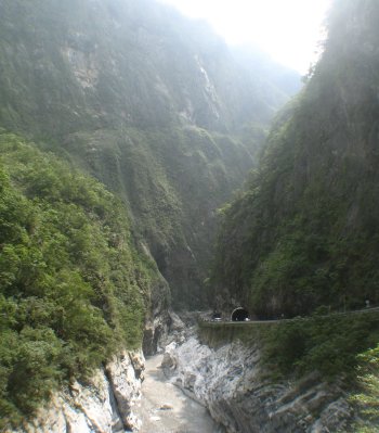
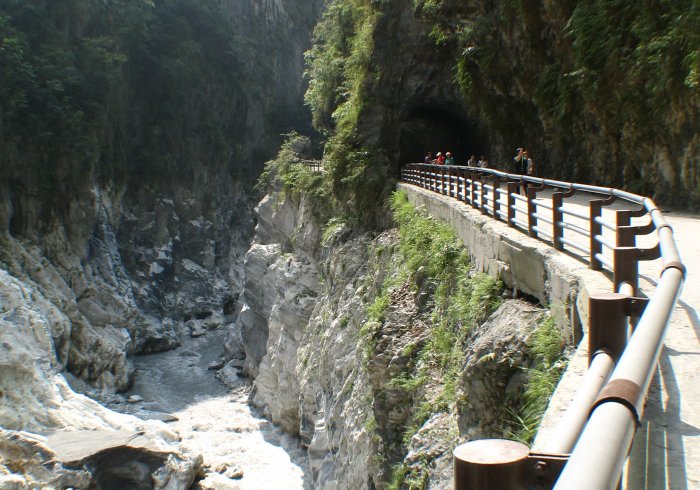
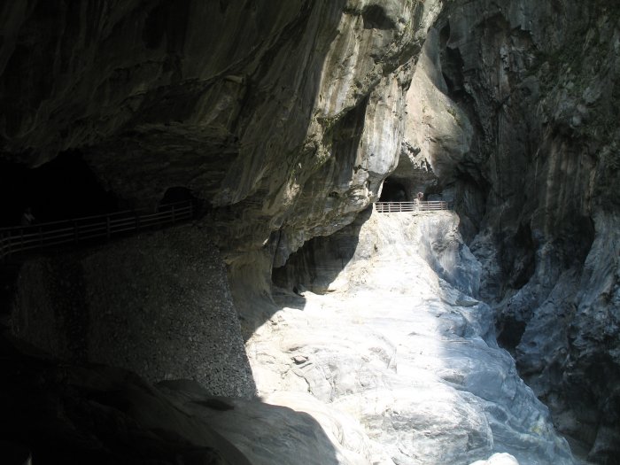
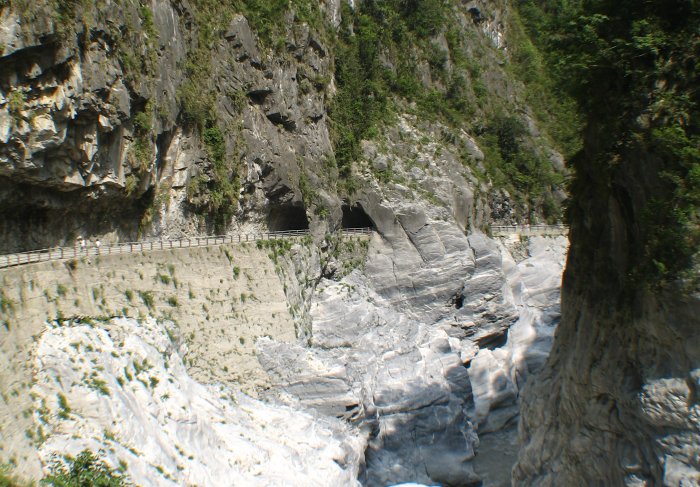
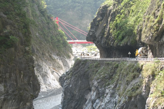
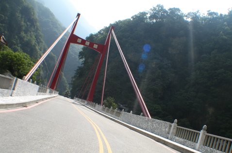
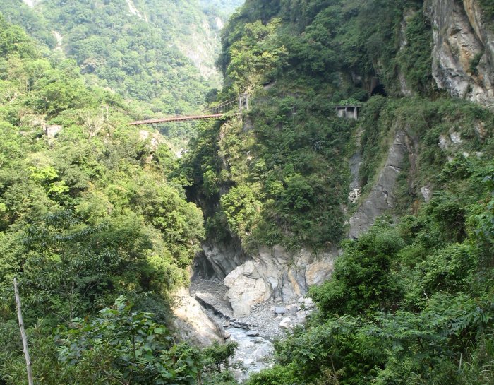
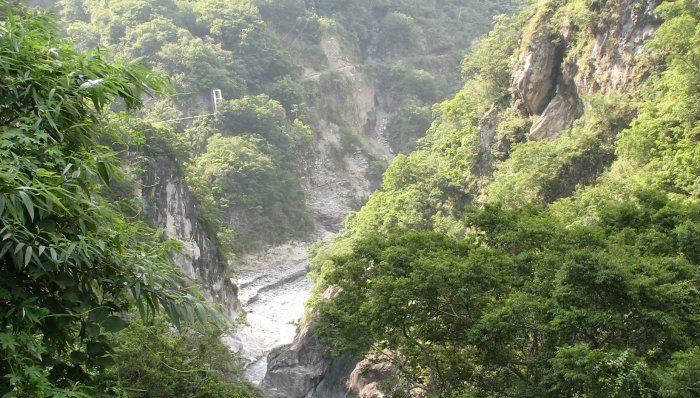
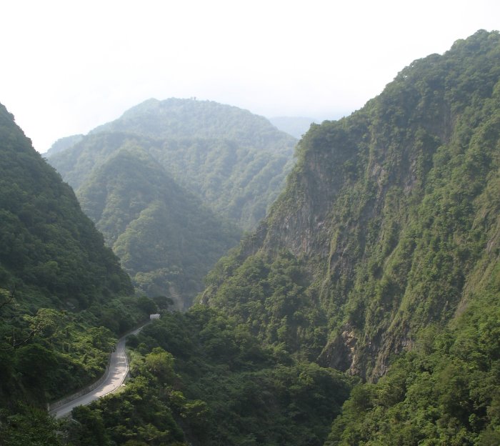
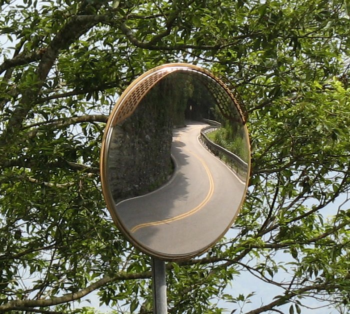
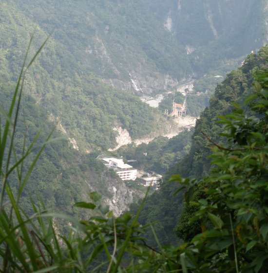
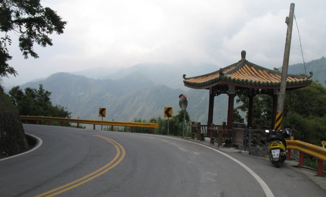
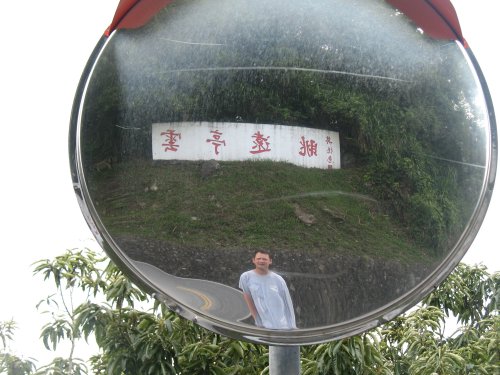
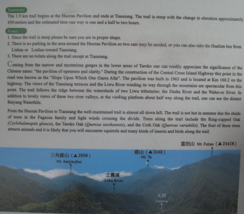
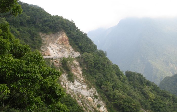
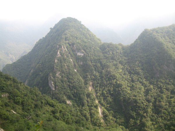
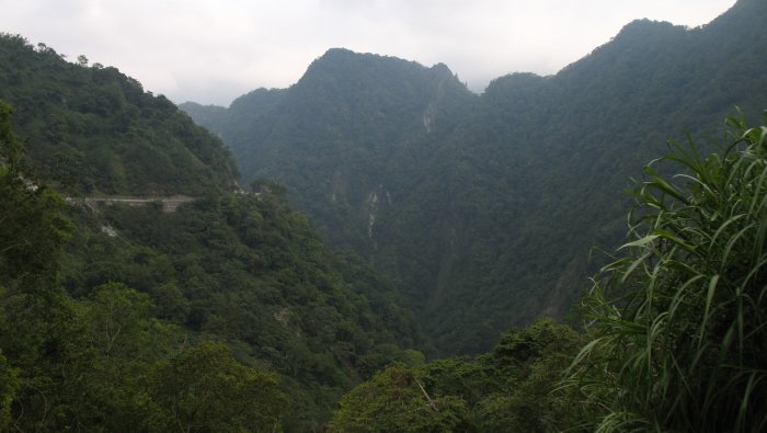
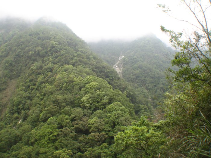
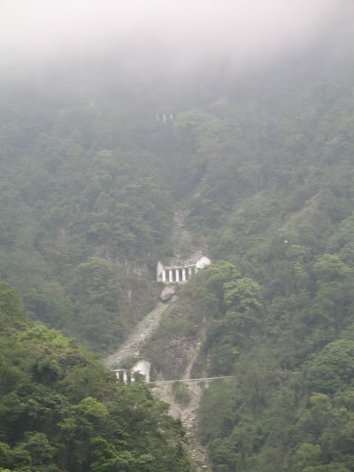
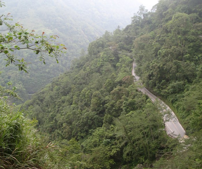
The
Gorge entrance isn't far north of Hualine - maybe 20 minutes. Once
there it became evident that this would be a spectacular event. I'll
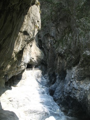
let the photos do much of the talking. The "lower" or eastern portion
is more "touristy" with tour buses and such. This section is also what
I would call "the narrows" - tall, steep sides with the roadway snaking
along just a bit above the rolling water.
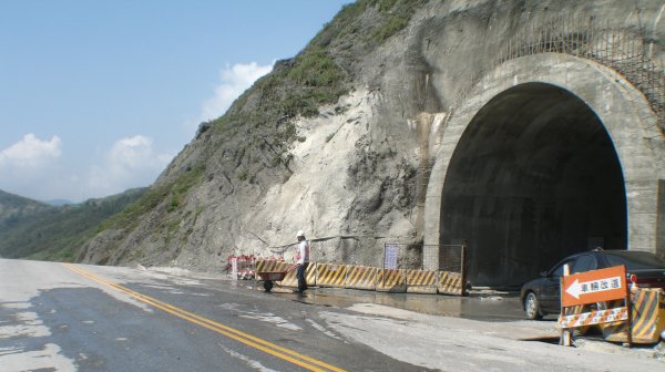
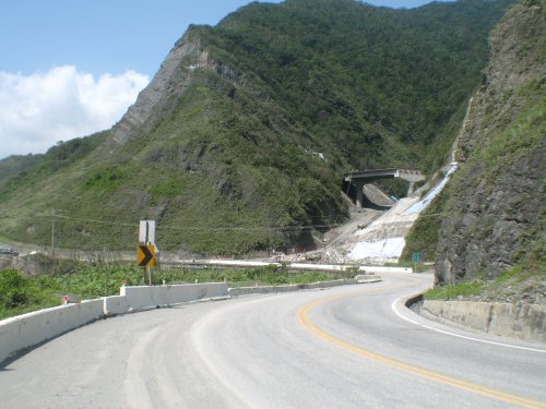
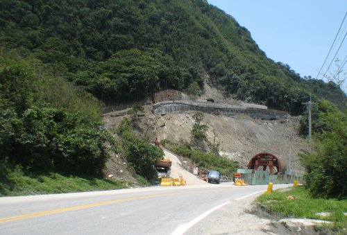
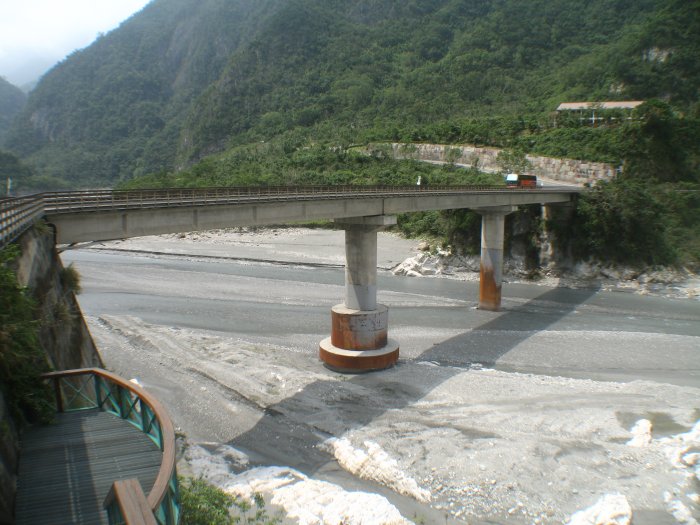
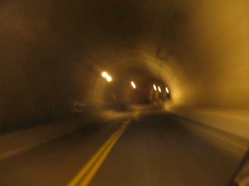
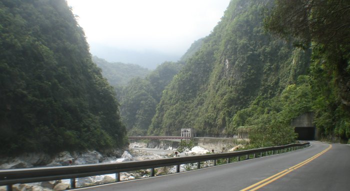
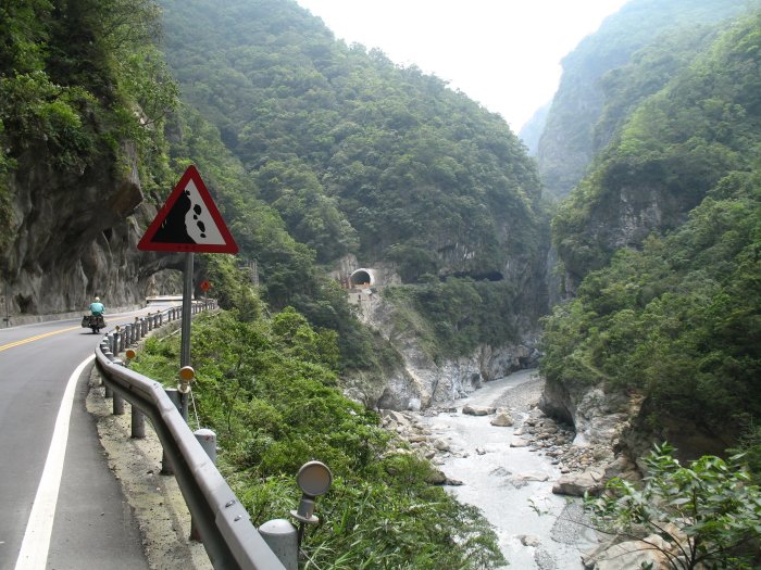
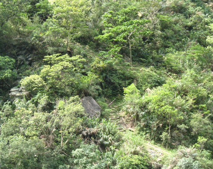
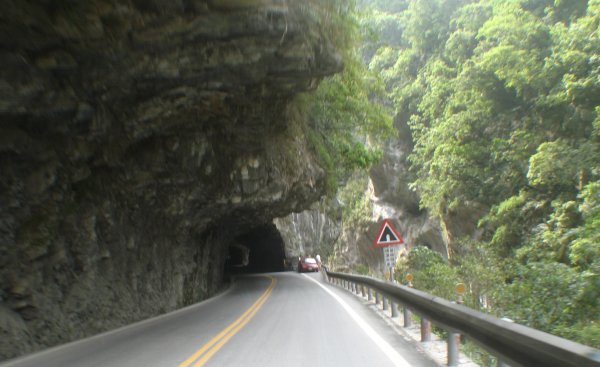
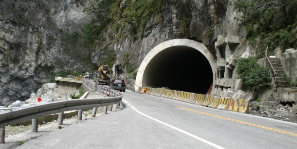
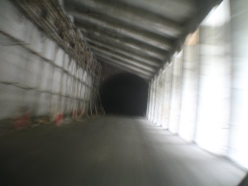
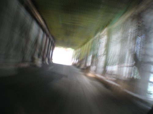
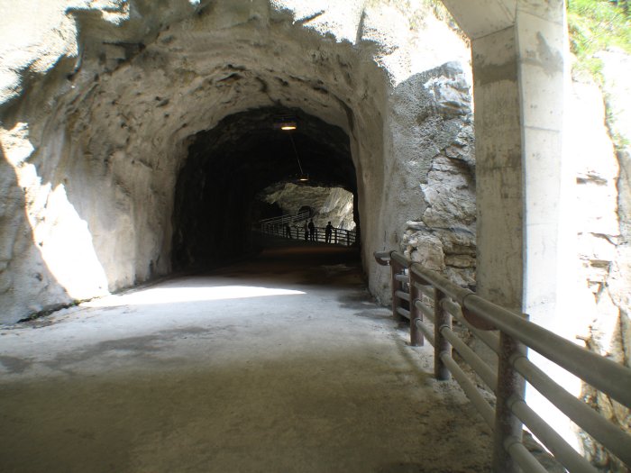
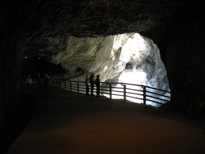
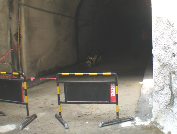
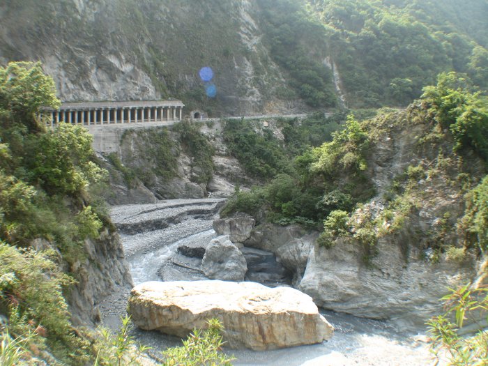
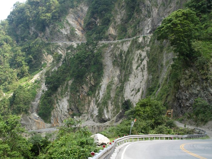
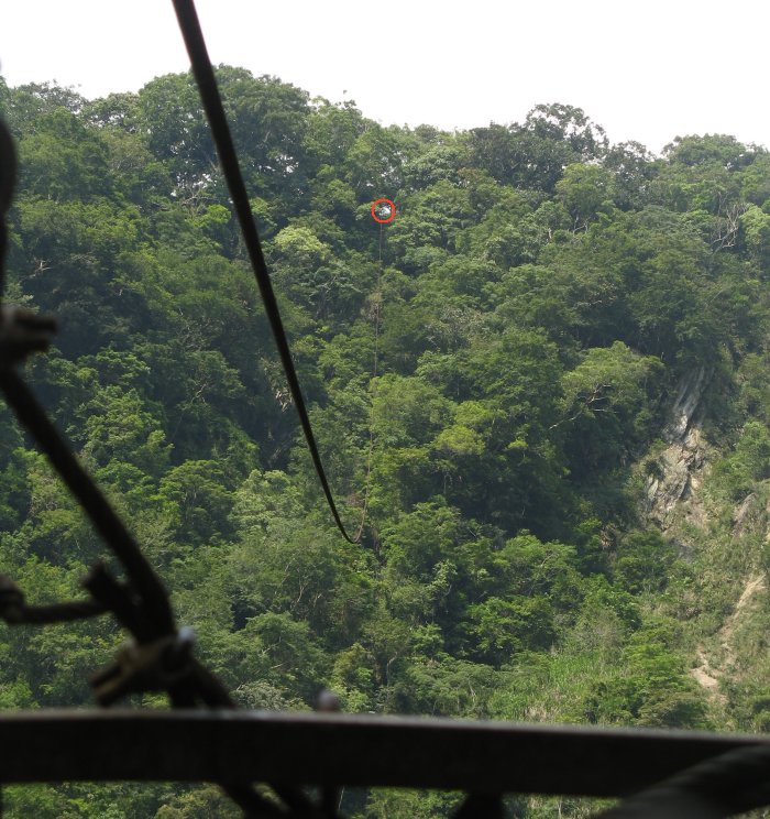
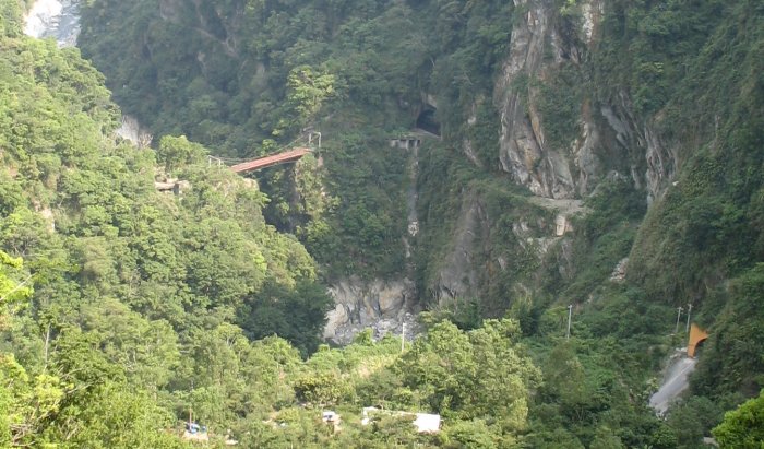
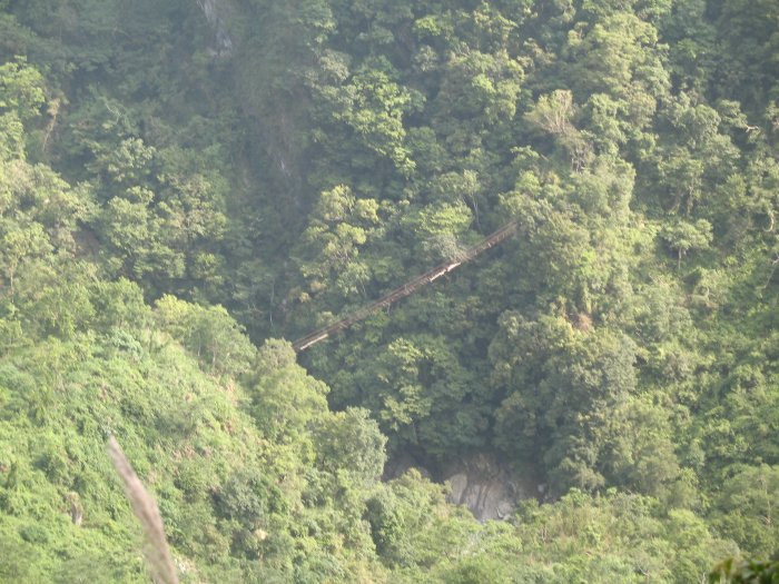
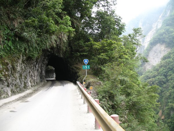
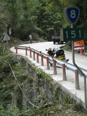
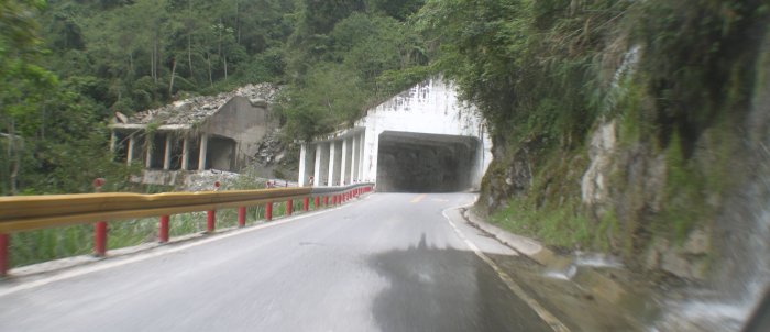
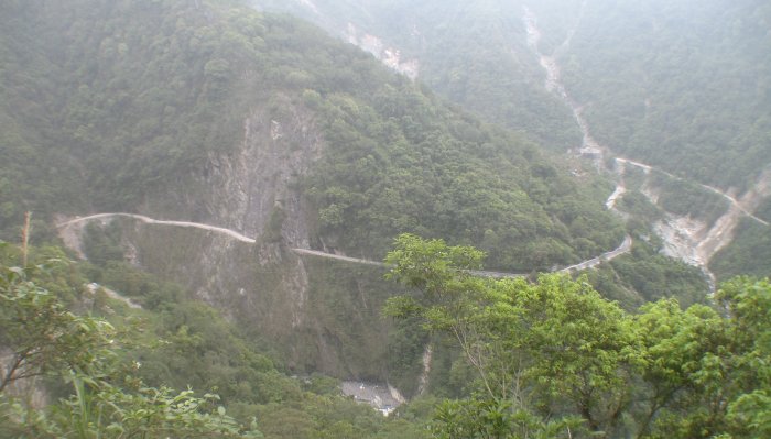
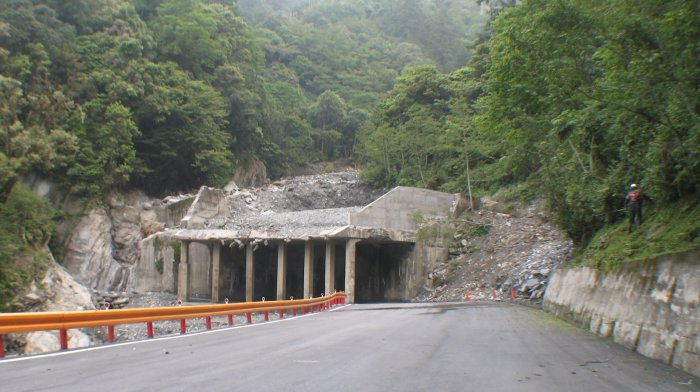
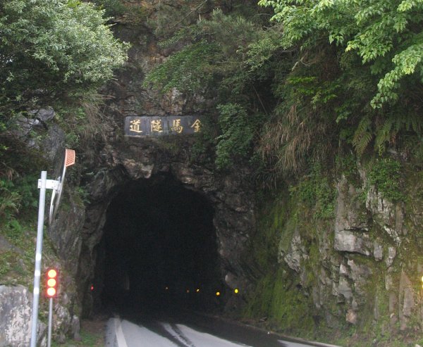
There are several
tunnels with new tunnels being constructed. Rolling through one of
the longer tunnels I noticed an "air vent / escape tunnel" off to my
left. They are somewhat common and are much like the main tunnel
itself. Taking the opportunity to see something perhaps a bit different
I pulled off into one of them (I could easily see out the other end)
and parked at the outer end of it. I walked out onto the old roadway -
what was used before the tunnel was opened. The roadway was turned into
a walking path. There were people about but nobody seemed to pay too
much to me parking the bike and walking out. I snapped a few photos and
headed back to the bike. Oddly this lady, a mother with her adult kids
nearby, started walking into this tunnel (possibly from seeing the bike
parked there). Her daughter said a few things to her but she kept
walking. When I walked past the daughter she had a look on her face - a
mix of despair and disgust. Oops - good thing I had left my helmet on!
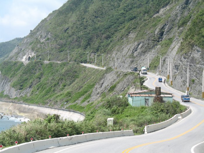
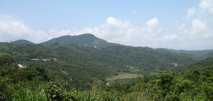
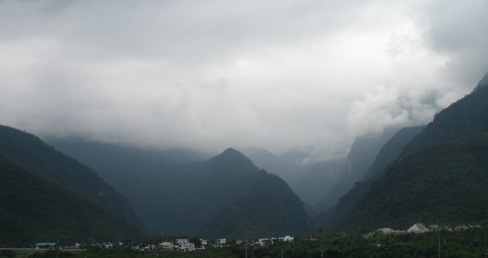
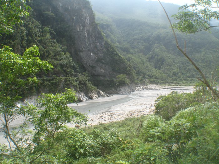
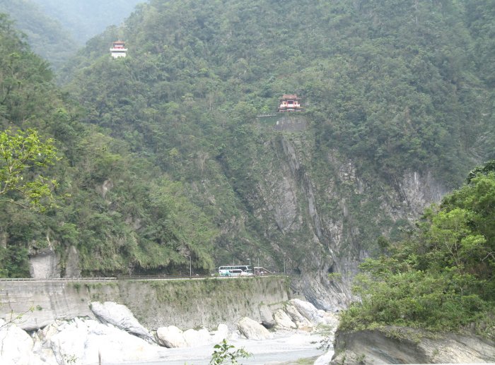
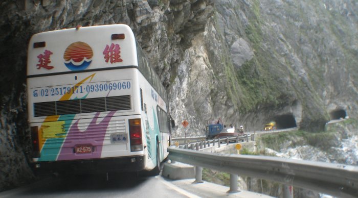
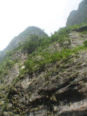
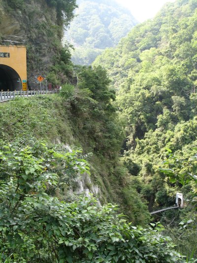
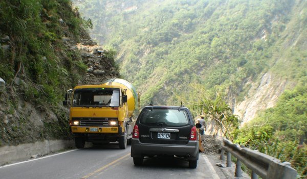
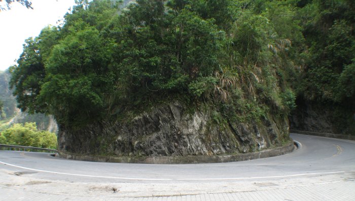
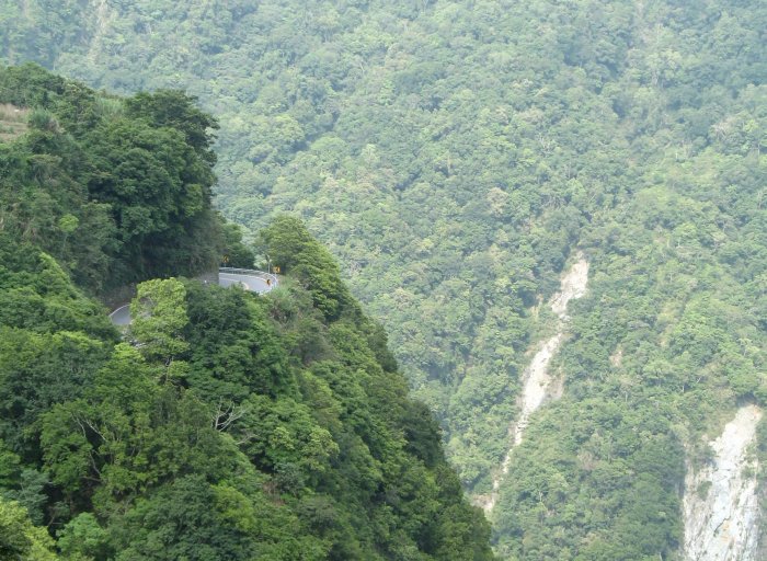
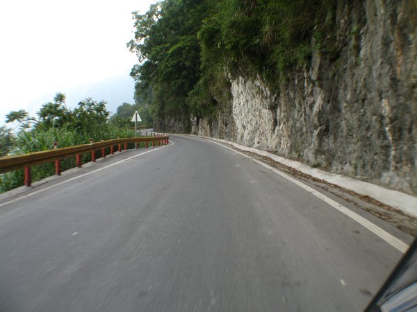
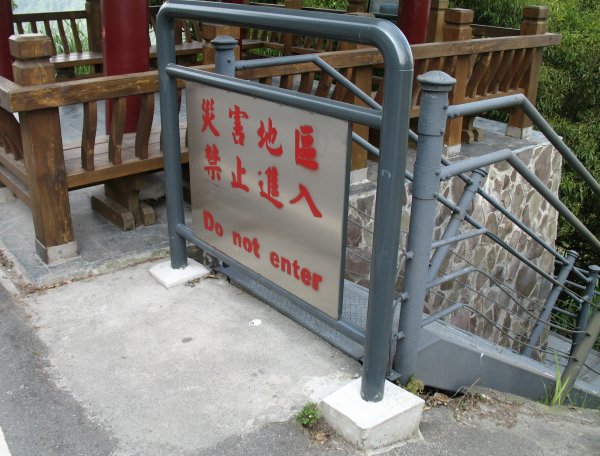
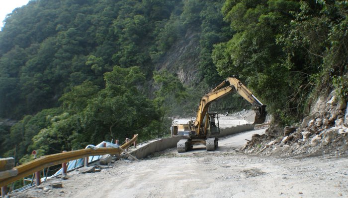
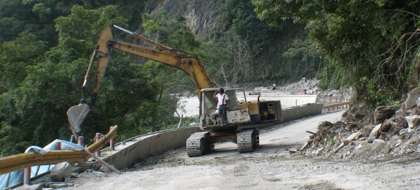
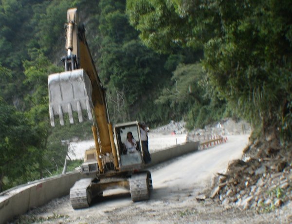
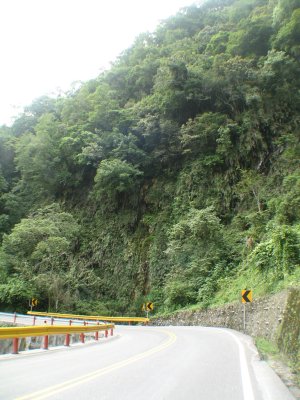
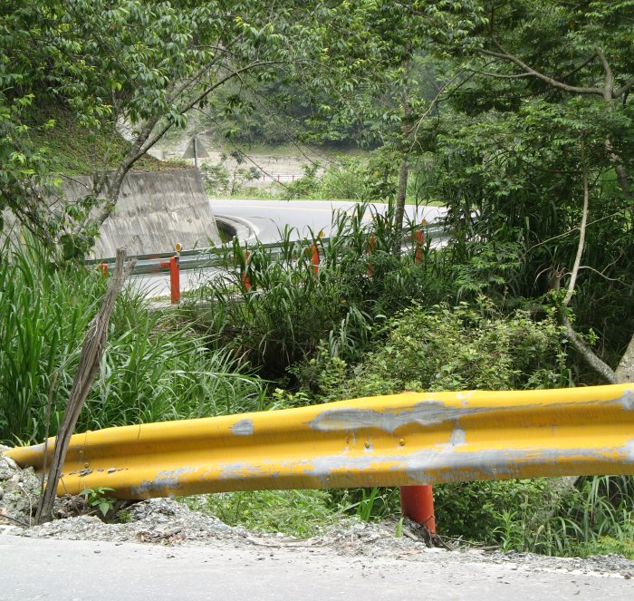
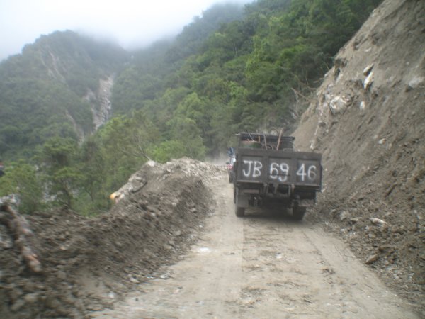
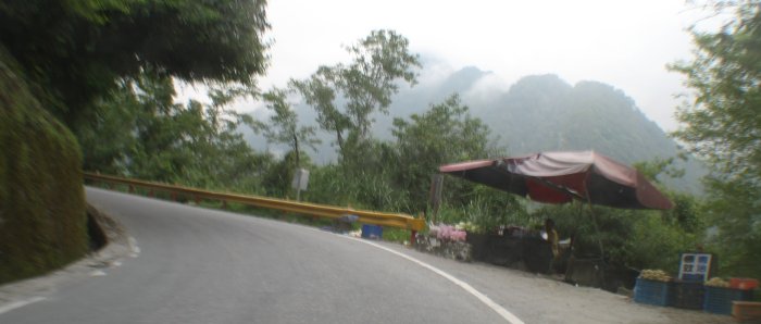
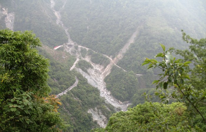
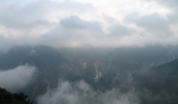
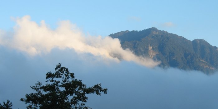
Farther
up / west the tourist traffic stops (the town of Sibau?) and the beauty
changes a bit - the vistas widen slightly and the road snakes upward.
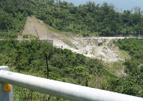
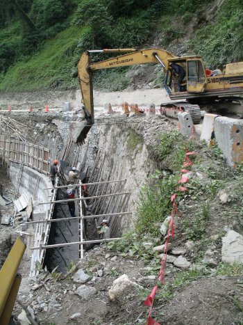
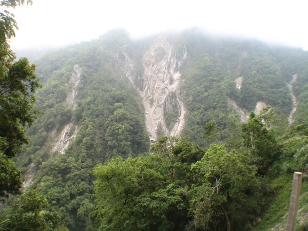
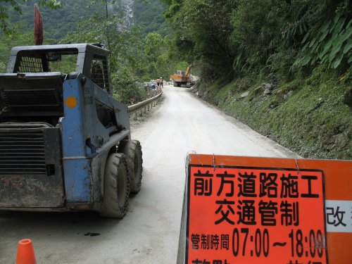
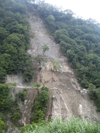
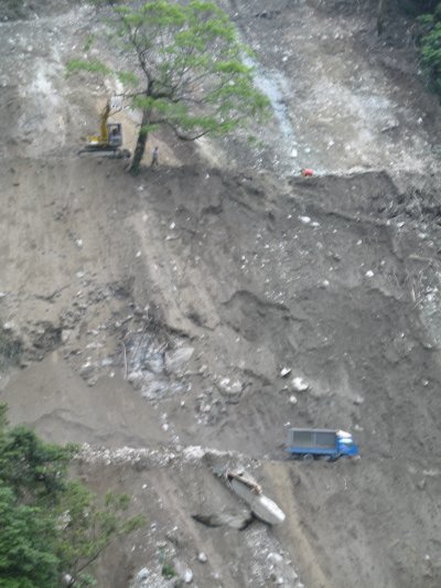
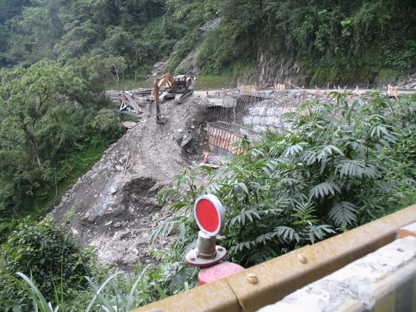
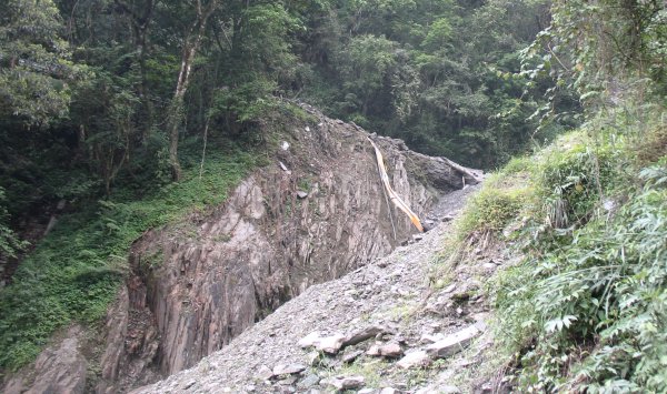
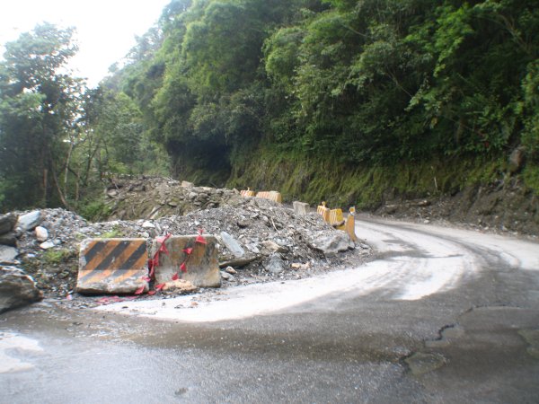
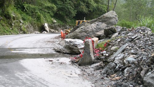
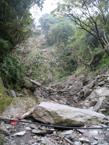
The road crews are eternal - I passed 5 to 10 construction sites - all
are a battle with Mother Nature. The road has a tenuous hold and must
hold a surprise or two after a heavy rain. Partial to near complete
road washouts and fortification efforts were underway. One site had us
at a 5 minute hold while another took perhaps 20 to 30 minutes between
traffic passage events. There weren't many vehicle on the road but when
I saw a pack of cars heading towards me I knew a long hold was up ahead.
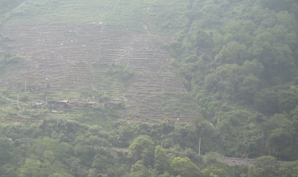
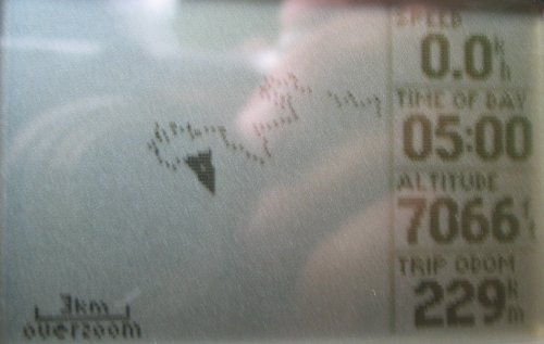
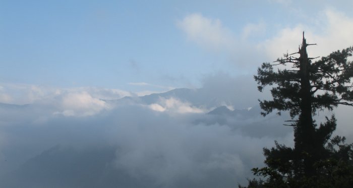
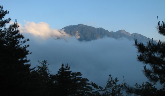
The
road kept twisting up and up. With the altitude increase came the
anticipated decrease in power from the 125cc 4-stroke (digital fuel
injected though). I'm not at the top yet - but the sun is soon to
disappear - and while I'm not hungry I do have a headache (not drinking
enough water though I am close to the 1 to 2 liter per day range). Need
Food Soon mode.
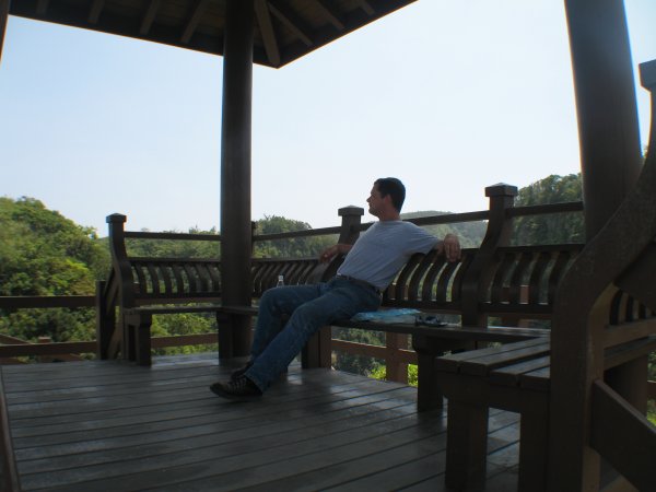
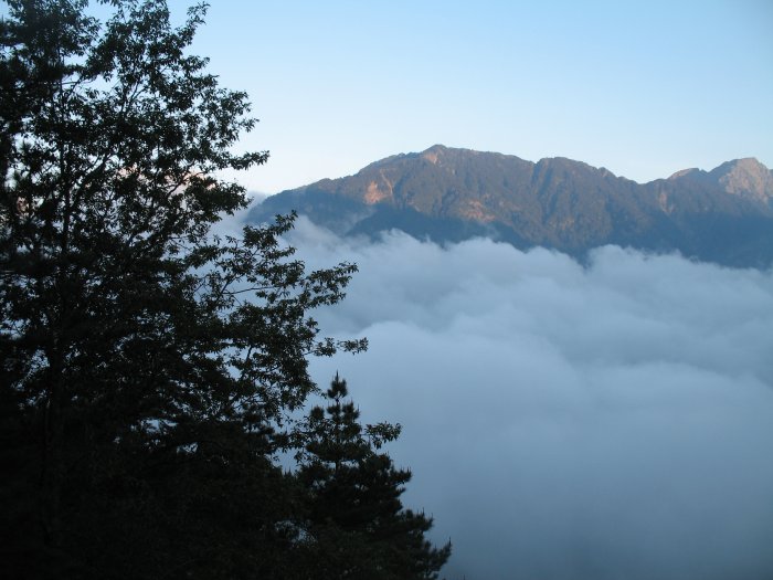
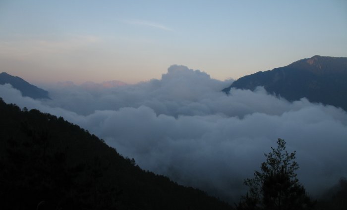
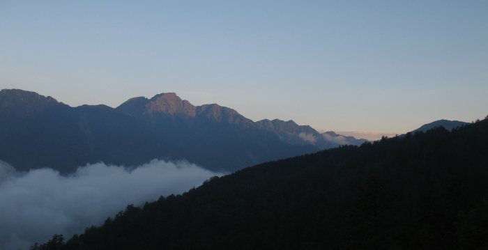
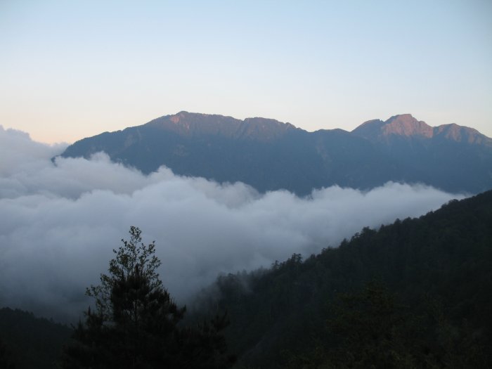
I see the hotel (referred by a policeman where I
stopped to ask about a hotel - 13 kilometers west). It'll be expensive
- and that's OK. A nice place on the mountain side with a fantastic
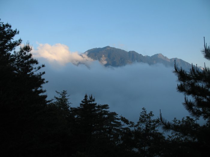
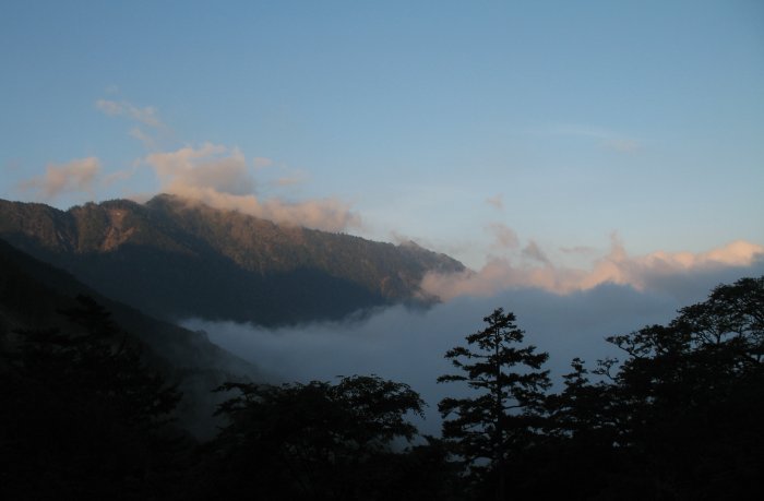
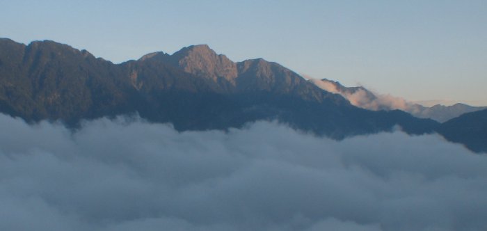
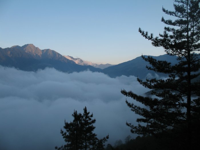
view to the east (too bad I'm not a morning person - sunrise is at
5:35am - specifically mentioned by the staff - I'll try to get up and
photo it for ya - no guarantee), I've been staying in "budget" places
so far.
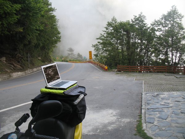
Well, as I type this I've had 1) some granola from the
bike to help calm the jitters, taken a nap in the heated bed (the room
isn't heated - the place is at about 8500 Feet MSL), taken a shower
with the HOT water (available from 16:00 to 22:00), eaten a hearty
dinner in the dining area. While a tinge of the headache exists I do
believe it will be gone by morning.
G'night.
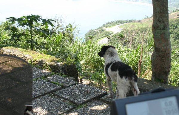
One more
thing - 3.5 legged dogs (and cats). I've seen a few of them - missing a
front or rear leg section. A couple dogs had what I would call fused
hips - legs that don't move much at all. Perhaps they got hit by a car?
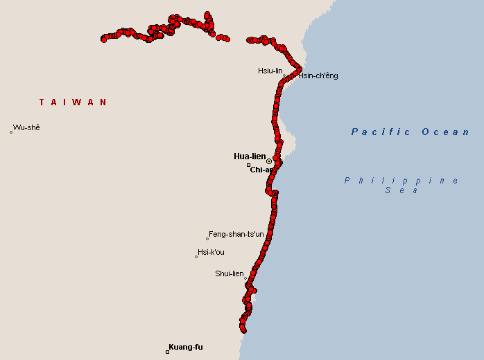
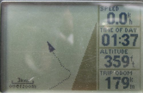
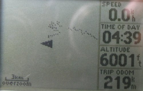
The dots today show missing sections. Loss of GPS signal either from tunnels or the steep, narrow canyon walls. |