Sunday Drive - Crown Point Road (aka the 19 mile dead ender)
|
A
blue sky Sunday afternoon. I had firm intent to stay home. But then I
turned a corner... 140 miles later this route was drawn on a map. |
| I
ended up riding deeper into the mountains - familiar roads for most
until I came to a side-road I've passed by time and again. Today I took
the turn. Down in town weather was in the mid 60's (F) for a nice day. I was a tad surprised to find decent snow in the shadows. Windows were being rolled up with the heater turning on. I didn't have the GPS running but I knew I was climbing in elevation. |
| About
30 minutes into the dead end drive I started to guess how long the dead
end road was to be. Pop out the phone's GPS map and I'm within a few
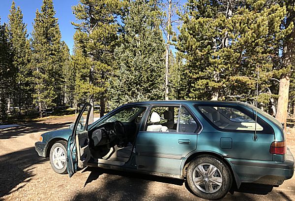
miles of the end - trek on. At the end is a parking lot for the
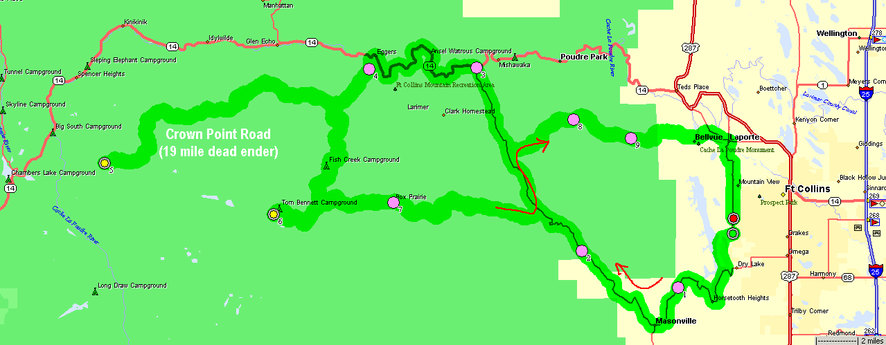
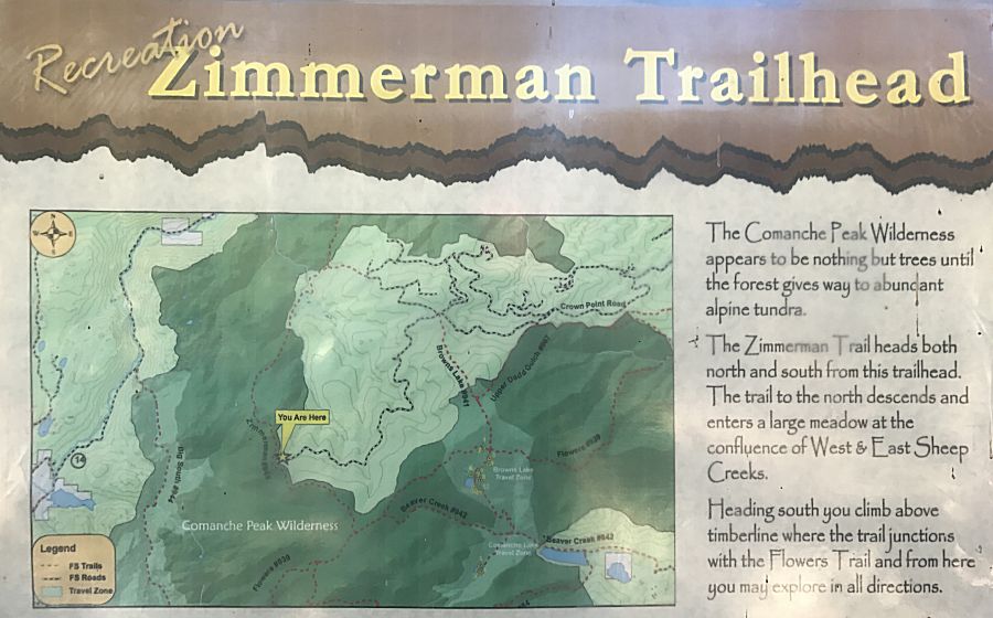
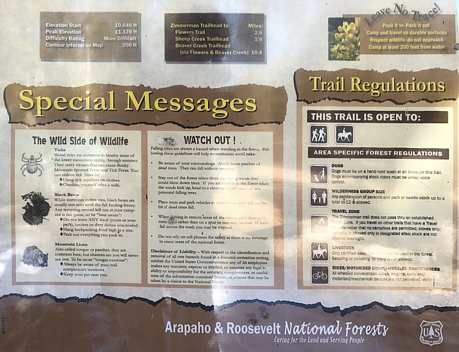
Zimmerman trailhead. Trails extend into the adjoining Comanche Peak
Wilderness (no motorized vehicles). The dark green areas on the
below map are wilderness. In the lighter green we have road. Much of
the road and trail are for logging operations. |
| This map states I'm about 10,646' for elevation - perhaps 20 degrees (F) cooler here than in town. |
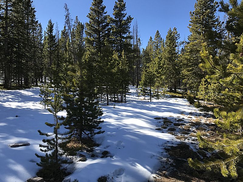
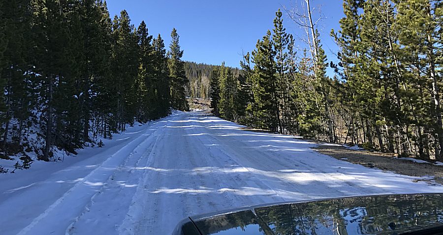
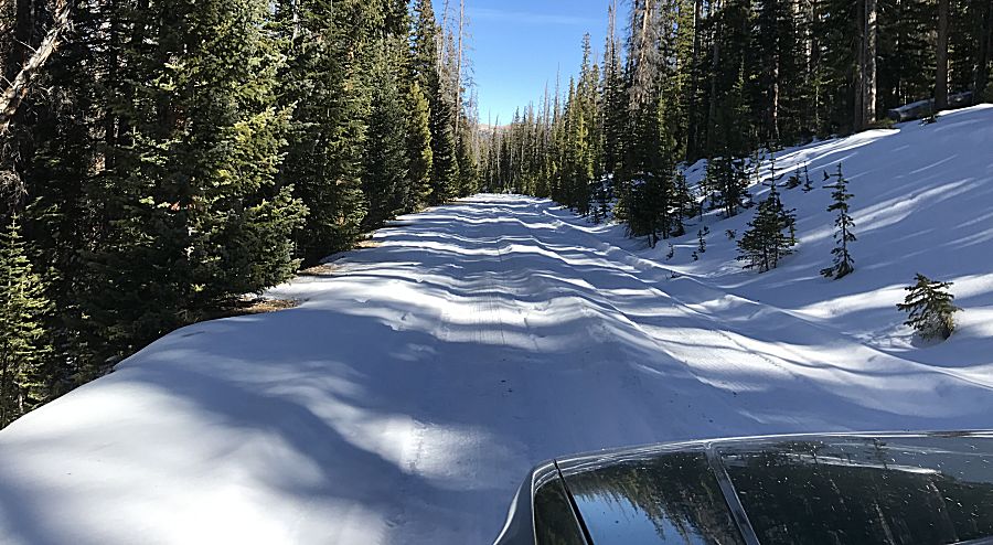
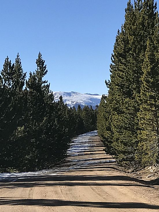
| There
were several sections of snow covered roadway. All was packed though a
couple sections had enough snow to gently rub the underside of the car.
It was slick with traffic near zero (I saw a couple hikers at the
trailhead - they were camping in the cool weather, a few vehicles down
the road for another trailhead - horse trailers). While speeds were low
(20-30MPH) I certainly wanted to stay in the center and not get stuck. |
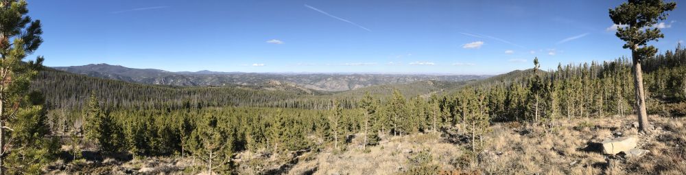
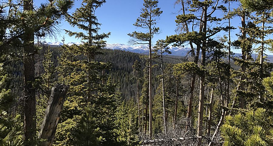
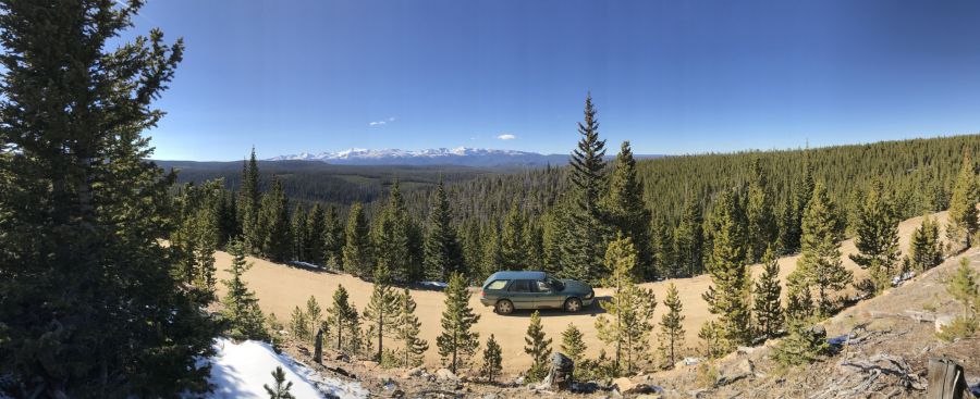
| Most
of the 19 mile trek was in a pine tree canyon. About 3/4 of the way to
the end I had a few glimpses of some snow covered mountains in the
distance. They surprised me. Snow covered mountains in the area? Up
north, we don't have overally tall mountains in the state. Now to find
the best spot for a photo of'm... |


| Most of the road was a good condition surface with spots of packed snow in the shadows. |
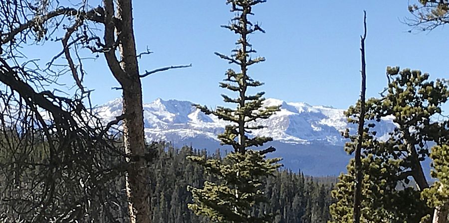
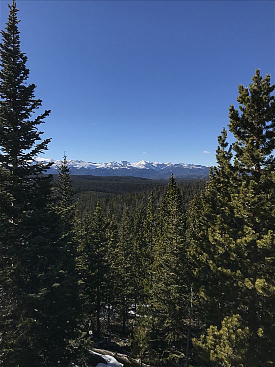
| There's
a bit more of an opening for a photo. Notice the low cut area of trees
in the pine tree carpet - areas that were harvested and are starting to
grow fresh. |
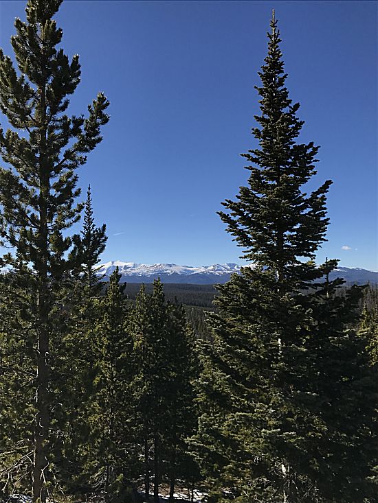
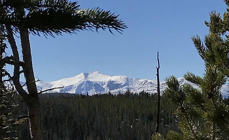
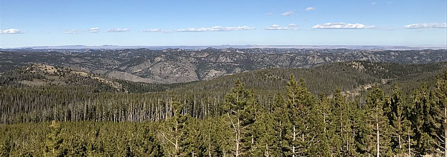
| Here
we go! In a more open area I was able to walk uphill slightly which
allowed me to get over many of the close, view blocking trees. |
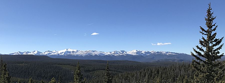
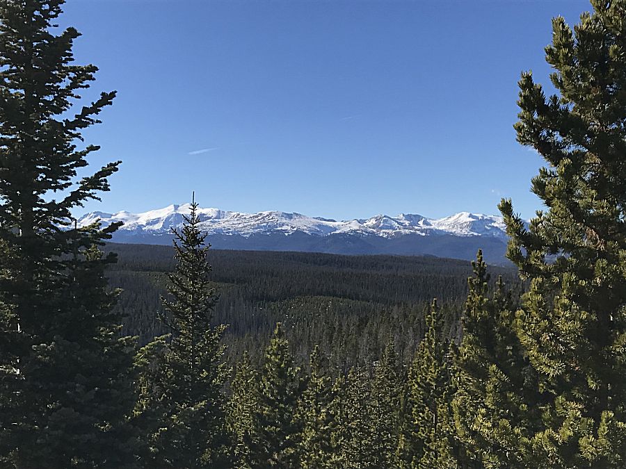
| click for a larger size How far are those moutains (11 miles west). Checking the maps... Those are the Medicine Bow Mountains. Over the mountains is North Park and the town of Walden. The tallest peak near the left / south end is Clark Peak at 12,953' elevation. To the right are South Rawah and North Rawah peaks. A tad bit later we'll make another stop with a view to the northeast. At the below map, we're at marker "A". |
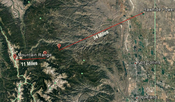
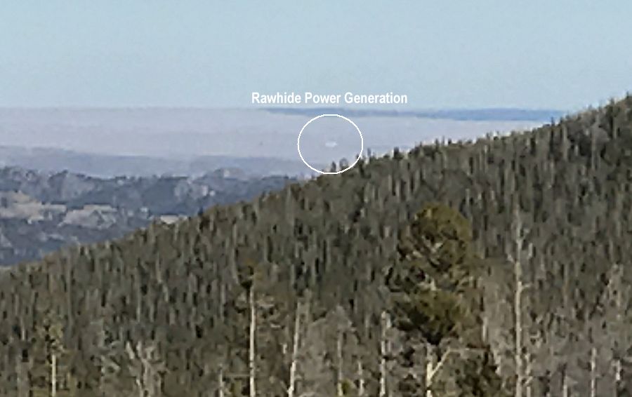
| Away
from the Medicine Bow Mountains view area we're at a second stop ("C")
with a view to the northeast. One light colored "block" of a building
is visible "out there" on the plains. There's only one large structure
in the area so I believe it's the Rawhide Power Generation plant. 34 miles east northeast |
| click for a larger size |